New Zealand Backcountry Huts
Huts in New Zealand Beginning with F
These are a mixture of Department of Conservation and private huts. Those without much information are more than likely privately owned and may or maynot be open to the public. If anyone has any information on any of them it would be great if you contacted me and let me know.
The price of a serviced hut is $15 a night, standard hut is $5 a night, Basic/Bivvy are free or you can get an annual pass for $122. All these prices are half price for 11-17 year olds or free if 10 years old and under. The Great Walk huts vary from place to place and season to season but to give you an idea it is $140 a night on the Milford (half price for New Zealanders) to $15 off season and for summer at least they need to be booked through DoC which you can do online @ DoC. I do plan to add the tracks that these huts are on but it is proving to be complicated.
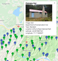
On each individual hut page I have included a zoomable topo map as well as a road map. Most of the information on these hut has been sourced from LINZ and DoC, so thanks to those two government departments :).
| Name | Latitude | Longitude | Area | Type | Photo | |
|---|---|---|---|---|---|---|
| Fanghill Hut | -43.1277531112 | 171.370634721 | Map | |||
| Felt Hut | -43.7284488181 | 170.820052362 | Map | |||
| Fenella Hut | -41.0496025591 | 172.525196898 | Cobb Valley, Kahurangi National Park | Serviced |  | Map |
| Ferguson Hut | -44.1194695505 | 169.55042479 | Hāwea Conservation Park | Standard |  | Map |
| Fern Burn Hut | -44.7398254685 | 168.984421805 | Wanaka area | Standard |  | Map |
| Fidgit Bivouac | -42.1767276429 | 173.629884256 | Map | |||
| Field Hut | -40.9078123657 | 175.256223074 | Map | |||
| Fishtail Hut | -41.4461290235 | 173.489445056 | Mount Richmond Forest Park | Standard | 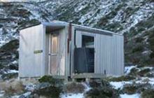 | Map |
| Flanagans Hut | -41.271779719 | 172.591157879 | Kahurangi National Park | Standard | 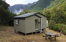 | Map |
| Flaxy Hut | -45.5701466671 | 168.887887494 | Map | |||
| Flora Hut | -41.1826395607 | 172.730003563 | Kahurangi National Park, Mount Arthur area | Basic/bivvies | 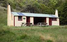 | Map |
| Flynns | -41.8984485133 | 173.779484091 | Map | |||
| Forbes Bivouac | -43.4648712218 | 170.648070844 | Map | |||
| Forbes Hut | -44.0489049427 | 169.619649234 | Hāwea Conservation Park | Standard | 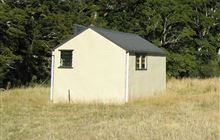 | Map |
| Forest Burn Shelter | -45.3894937998 | 167.5718408 | Map | |||
| Forks Hut | -40.1139088435 | 175.940019333 | Ruahine Forest Park | Standard | Map | |
| Forks Hut | -45.1138688492 | 168.127450955 | Mavora Lakes Conservation Park | Basic/bivvies | 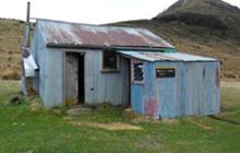 | Map |
| Fosters Hut | -41.430947513 | 173.640670889 | Mount Richmond Forest Park | Standard | 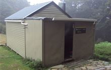 | Map |
| Fowlers Hut | -42.3133793833 | 172.764910755 | Map | |||
| Frampton's Hut | -35.5120728519 | 173.472813932 | Waima & Mataraua Forests | Standard | 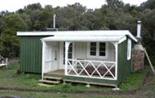 | Map |
| Franklin Hut | -44.028916966 | 169.094797405 | Map | |||
| Freds Camp Hut | -46.9284343154 | 167.977761752 | Rakiura National Park, Stewart Island/Rakiura | Standard | 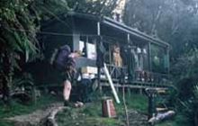 | Map |
| Freeman Burn Hut | -45.440449268 | 167.381172073 | Fiordland National Park, Lake Manapouri area | Standard | 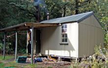 | Map |
| French Ridge Hut | -44.4286605403 | 168.693911261 | Matukituki Valley area, Mount Aspiring National Park | Serviced Alpine | 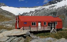 | Map |
| Freshwater Hut | -46.8682726783 | 167.920056996 | Rakiura National Park, Stewart Island/Rakiura | Standard | 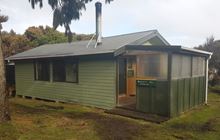 | Map |
| Frew Hut | -43.049539191 | 171.043453629 | Kokatahi River - Whitcombe River area | Standard | 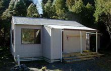 | Map |
| Frew Saddle Bivouac | -43.0768892503 | 171.091708049 | Map | |||
| Frisco Hut | -43.0316835953 | 171.110904809 | Kokatahi River - Whitcombe River area | Basic/bivvies | 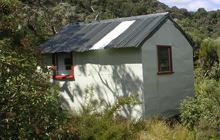 | Map |
[ A ] [ B ] [ C ] [ D ] [ E ] [ F ] [ G ] [ H ] [ I ] [ J ] [ K ] [ L ] [ M ] [ N ] [ O ] [ P ] [ Q ] [ R ] [ S ] [ T ] [ U ] [ V ] [ W ] [ Y ] [ Z ]