New Zealand Backcountry Huts
Huts in New Zealand Beginning with S
These are a mixture of Department of Conservation and private huts. Those without much information are more than likely privately owned and may or maynot be open to the public. If anyone has any information on any of them it would be great if you contacted me and let me know.
The price of a serviced hut is $15 a night, standard hut is $5 a night, Basic/Bivvy are free or you can get an annual pass for $122. All these prices are half price for 11-17 year olds or free if 10 years old and under. The Great Walk huts vary from place to place and season to season but to give you an idea it is $140 a night on the Milford (half price for New Zealanders) to $15 off season and for summer at least they need to be booked through DoC which you can do online @ DoC. I do plan to add the tracks that these huts are on but it is proving to be complicated.
On each individual hut page I have included a zoomable topo map as well as a road map. Most of the information on these hut has been sourced from LINZ and DoC, so thanks to those two government departments :).
| Name | Latitude | Longitude | Area | Type | Photo | |
|---|---|---|---|---|---|---|
| Sabine Hut | -41.9010982267 | 172.681312247 | Nelson Lakes National Park | Serviced |  | Map |
| Saddle (Mangaawai) Hut | -38.2747148503 | 176.939905102 | Map | |||
| Saddle Hut | -44.6352935994 | 168.884439306 | Map | |||
| Sainsburys Huts | -44.850488847 | 168.675838097 | Map | |||
| Saint Jacob's Hut | -42.6049275796 | 172.236302611 | Map | |||
| Saint Marys Hut | -45.2378882241 | 168.494659922 | Map | |||
| Saint Winifreds Hut | -43.4170570075 | 170.683107226 | Map | |||
| Sam Summers Hut | -45.0476272413 | 168.531444045 | Queenstown area | Basic/bivvies |  | Map |
| Sandfly Point Shelter | -44.684214235 | 167.901412477 | Map | |||
| Sandy Bay Hut | -38.7007944987 | 177.188795738 | Te Urewera | Serviced |  | Map |
| Savlon Hut | -38.2051126073 | 177.366513919 | Map | |||
| Sawyer Burn Hut | -44.4157700202 | 169.257022517 | Map | |||
| Saxon Hut | -40.886311026 | 172.308189427 | Kahurangi National Park | Great Walk | 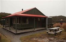 | Map |
| Saxton Hut | -42.0554802261 | 173.152283761 | Molesworth Station | Standard | 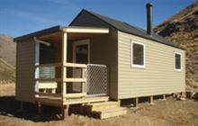 | Map |
| Sayer Hut | -40.9464743098 | 175.394187428 | Map | |||
| Scamper Torrent Hut | -43.1537295309 | 170.737485136 | Waitaha River area | Basic/bivvies | 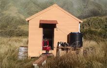 | Map |
| Scone Hut | -43.3757753247 | 170.569213965 | Whataroa area | Standard | 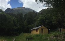 | Map |
| Scotties Hut | -42.4297608697 | 172.639972997 | St James Conservation Area | Basic/bivvies | 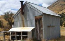 | Map |
| Scotts Rock Bivouac | -44.4192092284 | 168.680290995 | Map | |||
| Scottys Bivouac | -42.8071155258 | 171.412148872 | Map | |||
| Scrubby Hut | -44.1788862344 | 169.512471943 | Map | |||
| Sedgemere Sleepout | -42.1354837073 | 172.899854856 | Molesworth Station | Standard | 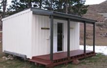 | Map |
| Sefton Bivvy | -43.6878971463 | 170.075809188 | Map | |||
| Seldom Inn Hut | -42.9077145498 | 172.296325645 | Map | |||
| Sentry Box Hut | -39.6687255609 | 176.281110564 | Map | |||
| Serpentine Hut | -43.0135024778 | 171.079377716 | Kokatahi River - Whitcombe River area | Basic/bivvies | 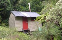 | Map |
| Severn Hut | -42.0618584152 | 173.036812958 | Molesworth Station | Standard | 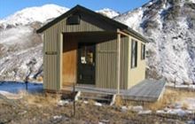 | Map |
| Seymour Hut | -42.2219823392 | 173.398658807 | Map | |||
| Shallow Bay Hut | -45.4933980679 | 167.612515822 | Fiordland National Park, Lake Manapouri area | Standard | 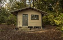 | Map |
| Shamrock Hut | -44.2070431378 | 169.622873199 | Ahuriri Conservation Park | Standard | 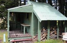 | Map |
| Shelter Rock Hut | -44.5587366889 | 168.508899507 | Mount Aspiring National Park | Serviced | 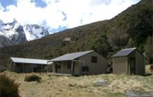 | Map |
| Shepherd Creek Hut | -45.4042229566 | 168.431963769 | Eyre Mountains/Taka Rā Haka Conservation Park | Basic/bivvies | 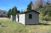 | Map |
| Shiel Burn Hut | -44.6809327919 | 168.73567564 | Map | |||
| Shutes Hut | -39.5117923257 | 176.292540197 | Map | |||
| Siberia Hut | -41.8793063261 | 173.074992127 | Leatham Conservation Area | Standard | 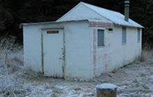 | Map |
| Siberia Hut | -45.2505493711 | 168.604946142 | Map | |||
| Siberia Hut | -44.2047411606 | 169.061640267 | Mount Aspiring National Park | Serviced | 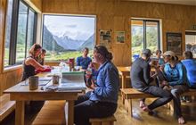 | Map |
| Silverstream Bivouac | -41.7938986603 | 173.042065123 | Map | |||
| Sir Robert Hut | -43.0586336175 | 171.155227861 | Kokatahi River - Whitcombe River area | Basic/bivvies | 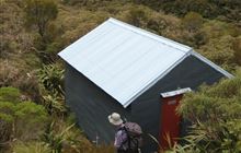 | Map |
| Sixteen Mile Huts | -44.6726028333 | 168.65042608 | Map | |||
| Skips Hut (Whangatawhia) | -38.7206001266 | 176.80009548 | Whirinaki Te Pua-a-Tāne Conservation Park | Standard | 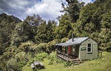 | Map |
| Slate Hut | -45.4701879043 | 168.750764065 | Map | |||
| Slaty Creek Hut | -42.5451093508 | 172.084696979 | Ahaura River and Lake Brunner catchments area | Basic/bivvies | 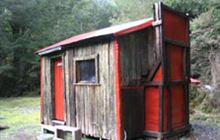 | Map |
| Slaty Hut | -41.4854904221 | 173.278412857 | Mount Richmond Forest Park | Standard | 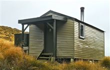 | Map |
| Slaughterburn Hut | -46.1922144951 | 167.066213545 | Fiordland National Park, Tuatapere area | Basic/bivvies |  | Map |
| Slip Flat Hut | -44.9563869793 | 168.274205211 | Greenstone and Caples Conservation Areas | Basic/bivvies | 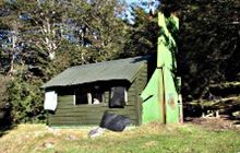 | Map |
| Smith Creek Shelter | -41.0541976273 | 175.277925624 | Map | |||
| Smiths Stream Hut | -39.8491632854 | 176.17042102 | Ruahine Forest Park | Standard | 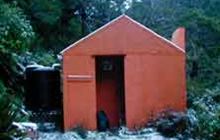 | Map |
| Smoky Hunters Hut | -46.7044142946 | 167.83143116 | Rakiura National Park, Stewart Island/Rakiura | Basic/bivvies | 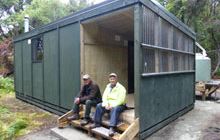 | Map |
| Smyth Hut | -43.2089822214 | 170.848797934 | Harihari area | Standard | 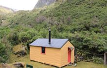 | Map |
[ A ] [ B ] [ C ] [ D ] [ E ] [ F ] [ G ] [ H ] [ I ] [ J ] [ K ] [ L ] [ M ] [ N ] [ O ] [ P ] [ Q ] [ R ] [ S ] [ T ] [ U ] [ V ] [ W ] [ Y ] [ Z ]