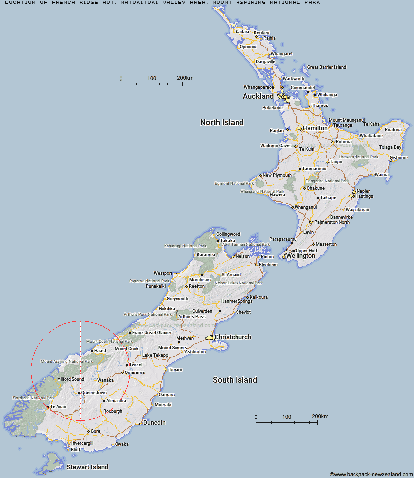
Topo Map showing location of French Ridge Hut
This information is sourced from DoC, LINZ and Openstreetmap. Some of the hut photos are mine and the rest are from DoC. I will be adding an upload feature soon so people can photos of .French Ridge Hut.
Basic info: This is an alpine serviced 20-bunk hut in the Wanaka/Makarora area.
Latitude: -44.4286605403
Longitude: 168.693911261
Location: Matukituki Valley area, Mount Aspiring National Park
Area: Otago
Type of Hut: Serviced Alpine
Tracks: French Ridge Track
Map: CA11 Topo Map | Road Map
Does this hut still exist? Have any more information? Contact
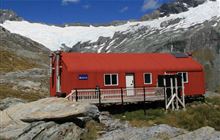
Image: DoC
Scroll down to see a topographical map and road map showing the location of French Ridge Hut
[ A ] [ B ] [ C ] [ D ] [ E ] [ F ] [ G ] [ H ] [ I ] [ J ] [ K ] [ L ] [ M ] [ N ] [ O ] [ P ] [ Q ] [ R ] [ S ] [ T ] [ U ] [ V ] [ W ] [ Y ] [ Z ]
Closest 20 Huts to French Ridge Hut
These are as the crow fliesScotts Rock Bivouac 1.51km Liverpool Hut 2.29km Aspiring Hut 6.02km Colin Todd Hut 6.29km Arawhata Rock Bivouac 7.02km Cascade Hut 7.42km Rock of Ages Bivouac 8.23km Raspberry Creek Shelter 10.3km Dart Hut 15.14km Tummel Burn Hut 15.68km Lochnagar Hut 19.49km Hundred Mile Hut 20.13km Shelter Rock Hut 20.6km Black Peak Hut 21.6km Top Forks Hut 23.25km Polnoon Hut 26.32km Sixteen Mile Huts 27.34km Saddle Hut 27.5km Shiel Burn Hut 28.25km Daleys Flat Hut 28.62km Albert Burn Hut 28.77km Earnslaw Hut 29.03km Twenty Five Mile Hut 29.48km Cabin Hut 30.44km Esquilant Bivvy Hut 30.8km Kerin Forks Hut 34.41km Ballarat Hut - Flood Burn 35.96km Wanaka Faces Hut 37.62km Olivine Hut 38.15km Siberia Hut 38.42km Craigie Burn Hut 39.1km Bullendale Hut 39.94km Archie's Hut - Copper Creek 41.1km Dynamo Hut 41.51km Fern Burn Hut 41.55km Spoon Hut 42.23km Young Hut 42.32km Highland Creek Hut 43.14km Roses Hut 43.87km Peats Hut 44.66km