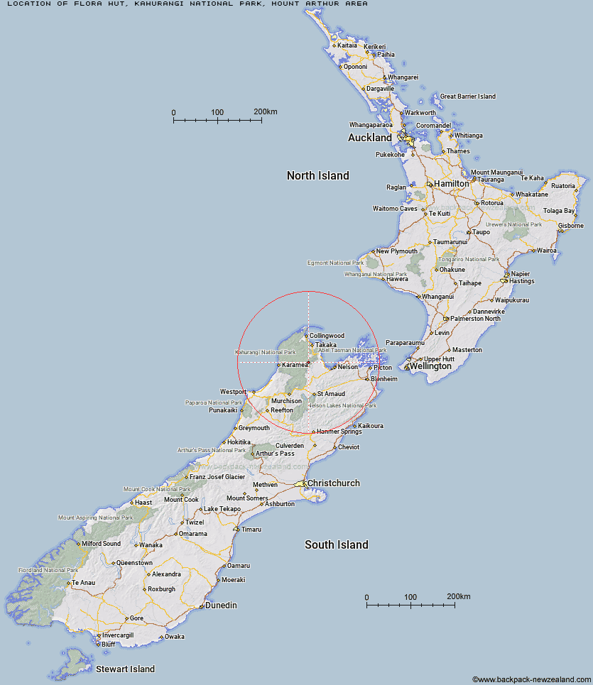
Topo Map showing location of Flora Hut
This information is sourced from DoC, LINZ and Openstreetmap. Some of the hut photos are mine and the rest are from DoC. I will be adding an upload feature soon so people can photos of .Flora Hut.
Basic info: Flora Hut is a short, easy walk from the road end making it a good overnight tramp for families with children.
Latitude: -41.1826395607
Longitude: 172.730003563
Location: Kahurangi National Park, Mount Arthur area
Area: Nelson/Tasman
Type of Hut: Basic/bivvies
Tracks: Flora Hut and Mount Arthur Hut tracks|Tableland Circuit
Map: BQ24 Topo Map | Road Map
Does this hut still exist? Have any more information? Contact
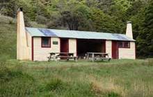
Image: DoC
Scroll down to see a topographical map and road map showing the location of Flora Hut
[ A ] [ B ] [ C ] [ D ] [ E ] [ F ] [ G ] [ H ] [ I ] [ J ] [ K ] [ L ] [ M ] [ N ] [ O ] [ P ] [ Q ] [ R ] [ S ] [ T ] [ U ] [ V ] [ W ] [ Y ] [ Z ]
Closest 20 Huts to Flora Hut
These are as the crow fliesMt Arthur Hut 2.06km Upper Gridiron Hut and Rock Shelters 3.1km Growler Rock Shelter 4.94km Dry Rock Shelter 5.87km Asbestos Cottage 6.7km Ellis Hut 7.16km Balloon Hut 9.13km Myttons Hut 10.46km Splugeons Rock Shelter 10.47km Sylvester Hut 11.14km Trilobite Hut 11.67km Flanagans Hut 15.27km Riordans Hut 15.29km Waingaro Forks Hut 15.95km Chaffey Hut 16.53km Tin Hut Shelter 18.81km Karamea Bend Hut 19.16km Tent Camp 20.76km Cobb Hut 22.21km Soper Shelter 22.56km Fenella Hut 22.65km Roaring Lion Hut 24.86km Crow Hut 25.08km Lonely Lake Hut 26.51km Venus Hut 28.51km John Reid Hut 28.69km Anatoki Forks Hut 28.93km Thor Hut 30.9km Castle Rock Hut 30.91km Adelaide Tarn Hut 30.93km Kiwi Saddle Hut 31.77km Moa Park Shelter 32.2km Holyoake Clearing Shelter 33.3km Wainui Hut 33.83km Boulder Lake Hut 33.89km Stone Hut 35.91km Trevor Carter Hut 37.14km Anchorage Hut 37.21km Kings Creek Hut 37.69km Cecil Kings Hut 37.92km