New Zealand Backcountry Huts
Huts in New Zealand Beginning with J
These are a mixture of Department of Conservation and private huts. Those without much information are more than likely privately owned and may or maynot be open to the public. If anyone has any information on any of them it would be great if you contacted me and let me know.
The price of a serviced hut is $15 a night, standard hut is $5 a night, Basic/Bivvy are free or you can get an annual pass for $122. All these prices are half price for 11-17 year olds or free if 10 years old and under. The Great Walk huts vary from place to place and season to season but to give you an idea it is $140 a night on the Milford (half price for New Zealanders) to $15 off season and for summer at least they need to be booked through DoC which you can do online @ DoC. I do plan to add the tracks that these huts are on but it is proving to be complicated.
On each individual hut page I have included a zoomable topo map as well as a road map. Most of the information on these hut has been sourced from LINZ and DoC, so thanks to those two government departments :).
| Name | Latitude | Longitude | Area | Type | Photo | |
|---|---|---|---|---|---|---|
| Jacko Flat Hut | -42.7079383783 | 171.630804667 | Ahaura River and Lake Brunner catchments area | Basic/bivvies | 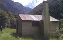 | Map |
| Jacks Hut | -42.9195344689 | 171.558831502 | Map | |||
| Jam Hut | -42.0955080483 | 173.715136364 | Ka Whata Tu o Rakihouia Clarence | Standard | 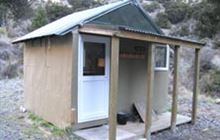 | Map |
| James Mackay Hut | -40.886074139 | 172.216915388 | Kahurangi National Park | Great Walk | Map | |
| Jans Hut | -41.3414754165 | 174.98222508 | Catchpool Valley & Orongorongo Valley, Remutaka Forest Park | Serviced | 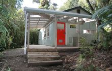 | Map |
| Jean Hut | -44.8538456486 | 168.446008358 | Map | |||
| Jellicoe Hut | -43.2810048153 | 171.114920252 | Map | |||
| Jervois Hut | -42.4154934248 | 172.578122905 | St James Conservation Area | Basic/bivvies | Map | |
| Jim Baird Hut | -45.6202690214 | 168.776680502 | Map | |||
| Jim's Flat Hut | -42.4345454667 | 171.730474275 | Ahaura River and Lake Brunner catchments area | Basic/bivvies | 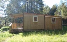 | Map |
| John Coull Hut | -39.2333906677 | 174.913496687 | Whanganui National Park | Great Walk | 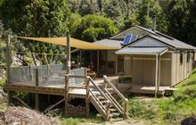 | Map |
| John Reid Hut | -41.4021779622 | 172.549597429 | Kahurangi National Park | Standard | 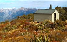 | Map |
| John Tait Hut | -41.9747641317 | 172.768641115 | Nelson Lakes National Park | Serviced | 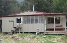 | Map |
| Johnson Hut | -41.4674021371 | 172.276131222 | Mokihinui River area | Basic/bivvies | 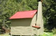 | Map |
| Jollie Brook Hut | -42.7199439154 | 172.333821195 | Map | |||
| Jollie Hut | -43.852903395 | 170.19866848 | Gamack Conservation Area | Basic/bivvies | 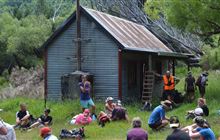 | Map |
| Jubilee Hut | -45.7190340077 | 170.440252952 | Silver Peaks Scenic Reserve | Standard | 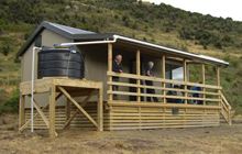 | Map |
| Julia Hut | -42.8976404611 | 171.424564903 | Kelly Range - Styx River area | Standard | 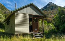 | Map |
| Jumbo Hut | -40.854342332 | 175.439786577 | Holdsworth area, Tararua Forest Park | Serviced | 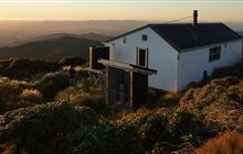 | Map |
| Junction Burn Hut | -45.150980299 | 167.498085005 | Fiordland National Park | Standard | 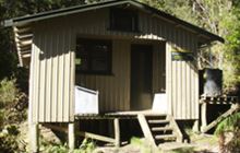 | Map |
| Junction Hut | -45.5599092321 | 168.897115022 | Old Woman and Old Man/Kopuwai Ranges | Standard | 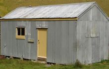 | Map |
| Junction Hut | -42.0340091293 | 173.204431137 | Old Woman and Old Man/Kopuwai Ranges | Standard | | Map |
| Junction Hut | -44.5268731819 | 169.366465359 | Old Woman and Old Man/Kopuwai Ranges | Standard | | Map |
| Junction Hut | -45.5106629961 | 169.184034162 | Old Woman and Old Man/Kopuwai Ranges | Standard | | Map |
[ A ] [ B ] [ C ] [ D ] [ E ] [ F ] [ G ] [ H ] [ I ] [ J ] [ K ] [ L ] [ M ] [ N ] [ O ] [ P ] [ Q ] [ R ] [ S ] [ T ] [ U ] [ V ] [ W ] [ Y ] [ Z ]