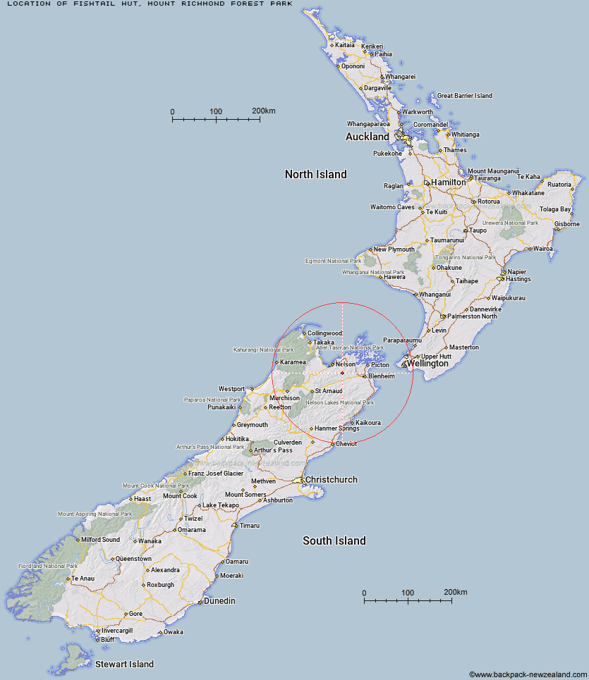
Topo Map showing location of Fishtail Hut
This information is sourced from DoC, LINZ and Openstreetmap. Some of the hut photos are mine and the rest are from DoC. I will be adding an upload feature soon so people can photos of .Fishtail Hut.
Basic info: standard 4-bunk hut in the South Marlborough area.
Latitude: -41.4461290235
Longitude: 173.489445056
Location: Mount Richmond Forest Park
Area: Marlborough
Type of Hut: Standard
Tracks: Mt Fishtail Route
Map: BQ27 Topo Map | Road Map
Does this hut still exist? Have any more information? Contact
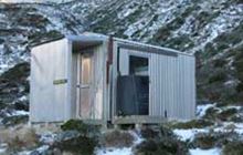
Image: DoC
Scroll down to see a topographical map and road map showing the location of Fishtail Hut
[ A ] [ B ] [ C ] [ D ] [ E ] [ F ] [ G ] [ H ] [ I ] [ J ] [ K ] [ L ] [ M ] [ N ] [ O ] [ P ] [ Q ] [ R ] [ S ] [ T ] [ U ] [ V ] [ W ] [ Y ] [ Z ]
Closest 20 Huts to Fishtail Hut
These are as the crow fliesMt Fell Hut 6.36km Devils Creek Hut 8.04km Captain Creek Hut 9.21km Richmond Saddle Hut 9.37km Middy Creek Hut 10.61km Roebuck Hut 11.65km Fosters Hut 12.72km Rocks Hut 14.22km Chimney 14.53km Dun Shelter 14.96km Mt Sunday Bivouac 16.32km Browning Hut 18.09km Slaty Hut 18.12km Third House Shelter 19.22km Lake Chalice Hut 19.54km Old Man Hut 20.18km Hacket Hut 20.59km Starveall Hut 20.7km Mt Rintoul Hut 23.82km Mid Goulter Hut 25.89km Tarn Hut 29.23km McNaughts Hut 31.64km Lower Goulter Hut 31.99km Ramshead Hut 32.1km Mid Wairoa Hut 33.63km Beehive Hut 35.1km Dillon Hut 35.15km Turkeys Nest Bivouac 36.25km Hidden Hut 36.4km Lake Alexander Hut 36.64km Omaka Bivouac 36.73km Gosling Hut 37.89km Tinpot Hut 38.69km Top Wairoa Hut 39.03km Black Birch Bivouac 40.89km Penk Hut 41.19km Boulder Forks Hut 42.94km Hunters Hut 43.94km Top Whare 44.53km Porters Creek Hut 47.01km