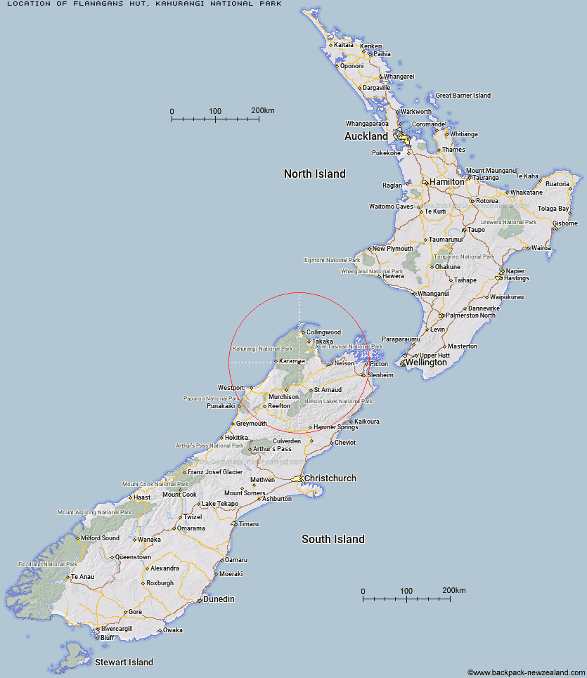
Topo Map showing location of Flanagans Hut
This information is sourced from DoC, LINZ and Openstreetmap. Some of the hut photos are mine and the rest are from DoC. I will be adding an upload feature soon so people can photos of .Flanagans Hut.
Basic info: standard 8-bunk hut in the Motueka area.
Latitude: -41.271779719
Longitude: 172.591157879
Location: Kahurangi National Park
Area: Nelson/Tasman
Type of Hut: Standard
Map: BQ23 Topo Map | Road Map
Does this hut still exist? Have any more information? Contact
Basic info: standard 8-bunk hut in the Motueka area.
Latitude: -41.271779719
Longitude: 172.591157879
Location: Kahurangi National Park
Area: Nelson/Tasman
Type of Hut: Standard
Map: BQ23 Topo Map | Road Map
Does this hut still exist? Have any more information? Contact
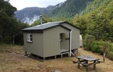
Image: DoC
Scroll down to see a topographical map and road map showing the location of Flanagans Hut
[ A ] [ B ] [ C ] [ D ] [ E ] [ F ] [ G ] [ H ] [ I ] [ J ] [ K ] [ L ] [ M ] [ N ] [ O ] [ P ] [ Q ] [ R ] [ S ] [ T ] [ U ] [ V ] [ W ] [ Y ] [ Z ]
Closest 20 Huts to Flanagans Hut
These are as the crow fliesSplugeons Rock Shelter 7.53km Karamea Bend Hut 7.96km Ellis Hut 8.77km Crow Hut 10.51km Balloon Hut 11.71km Dry Rock Shelter 11.95km Mt Arthur Hut 13.28km Growler Rock Shelter 13.6km Venus Hut 13.63km Upper Gridiron Hut and Rock Shelters 14.29km John Reid Hut 14.91km Flora Hut 15.27km Myttons Hut 15.34km Roaring Lion Hut 15.52km Thor Hut 15.67km Trilobite Hut 15.81km Kiwi Saddle Hut 17.07km Asbestos Cottage 17.91km Sylvester Hut 18.96km Chaffey Hut 19.75km Stone Hut 20.84km Trevor Carter Hut 21.87km Tent Camp 23.32km Kings Creek Hut 23.41km Cecil Kings Hut 23.62km Cobb Hut 24.63km Kākāpō Hut 24.95km Helicopter Flat Hut 25.03km Fenella Hut 25.31km Waingaro Forks Hut 26.1km Greys Hut 26.62km Taipo Hut 27.08km Granity Pass Hut 28.05km Riordans Hut 28.18km Stag Flat Shelter 28.31km Branch Creek Hut 28.82km Wangapeka Bivouac 28.86km Soper Shelter 29.53km Belltown Manunui Hut 30.83km Hurricane Hut 31.39km