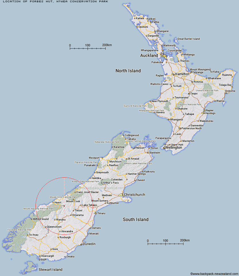
Topo Map showing location of Forbes Hut
This information is sourced from DoC, LINZ and Openstreetmap. Some of the hut photos are mine and the rest are from DoC. I will be adding an upload feature soon so people can photos of .Forbes Hut.
Basic info: standard six-bunk hut in the Wanaka/Makarora area.
Latitude: -44.0489049427
Longitude: 169.619649234
Location: Hāwea Conservation Park
Area: Otago
Type of Hut: Standard
Map: BZ14 Topo Map | Road Map
Does this hut still exist? Have any more information? Contact
Basic info: standard six-bunk hut in the Wanaka/Makarora area.
Latitude: -44.0489049427
Longitude: 169.619649234
Location: Hāwea Conservation Park
Area: Otago
Type of Hut: Standard
Map: BZ14 Topo Map | Road Map
Does this hut still exist? Have any more information? Contact
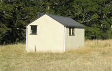
Image: DoC
Scroll down to see a topographical map and road map showing the location of Forbes Hut
[ A ] [ B ] [ C ] [ D ] [ E ] [ F ] [ G ] [ H ] [ I ] [ J ] [ K ] [ L ] [ M ] [ N ] [ O ] [ P ] [ Q ] [ R ] [ S ] [ T ] [ U ] [ V ] [ W ] [ Y ] [ Z ]
Closest 20 Huts to Forbes Hut
These are as the crow fliesTop Hut 8.91km Ferguson Hut 9.6km South Huxley Bivouac 9.75km Main Huxley Forks Hut 10.93km Hagens Hut 11.95km Brodrick Hut 11.99km Wills Hut 12.67km Bull Flat Hut 13.77km South Temple Hut 14.06km Creswicke Flat Hut 15.05km Monument Hut 15.62km Scrubby Hut 16.8km Makarora Hut 16.87km Brewster Hut 17.12km Shamrock Hut 17.59km Red Hut 18.01km Dasler Bivouac 20.83km Maitland Hut 21.08km Elcho Hut 21.33km Cullers Hut 22.35km Le Crens Hut 24.54km Boundary Hut 24.58km Ahuriri Base Hut 24.86km Little Boundary Hut 25.53km Green Bush Hut 25.93km Top Dingle Hut 26.25km Tunnel Creek Hut 26.47km Snowy Gorge Hut 26.76km Dodger Hut 26.83km Middle Head Hut 28.29km Station Hut 28.6km Grough Hut 29.15km Roaring Billy Hut 29.24km Cameron Hut 29.44km Stony Stream Bivouac 29.84km Horseshoe Flat Hut 31.31km High Burn Hut 31.92km Erceg Hut 32.65km Ben Avon Hut 32.8km Kennedy Hut 33.32km