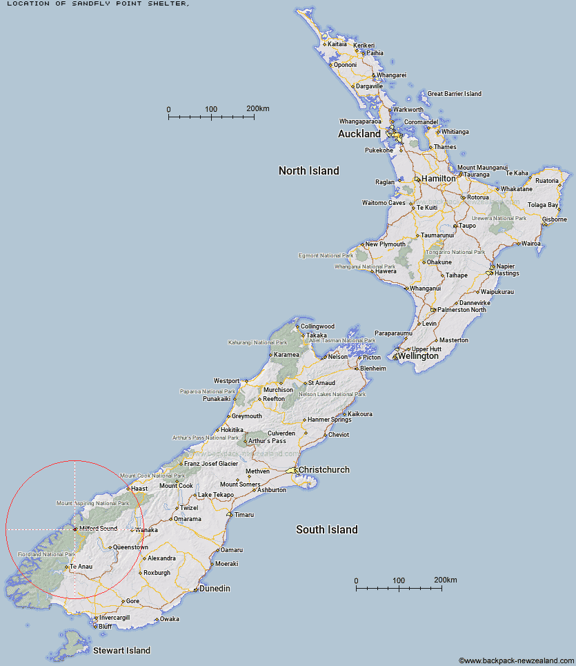
Topo Map showing location of Sandfly Point Shelter
This information is sourced from DoC, LINZ and Openstreetmap. Some of the hut photos are mine and the rest are from DoC. I will be adding an upload feature soon so people can photos of .Sandfly Point Shelter.
Latitude: -44.684214235
Longitude: 167.901412477
Location:
Type of Hut:
Map: Topo Map | Road Map
Does this hut still exist? Have any more information? Contact
Latitude: -44.684214235
Longitude: 167.901412477
Location:
Type of Hut:
Map: Topo Map | Road Map
Does this hut still exist? Have any more information? Contact
Scroll down to see a topographical map and road map showing the location of Sandfly Point Shelter
[ A ] [ B ] [ C ] [ D ] [ E ] [ F ] [ G ] [ H ] [ I ] [ J ] [ K ] [ L ] [ M ] [ N ] [ O ] [ P ] [ Q ] [ R ] [ S ] [ T ] [ U ] [ V ] [ W ] [ Y ] [ Z ]
Closest 20 Huts to Sandfly Point Shelter
These are as the crow fliesGiant Gate Shelter 4.69km Boatshed Hut 9.86km Boatshed Shelter 9.89km Turners Bivouac 11.82km Gill's Bivvy 11.96km Homer Hut 12.22km Pawnbroker Rock 12.44km Phil's Bivvy 12.62km Dumpling Hut 14.27km Andersons Cascade Shelter 15.83km Mackinnon Pass Shelter 16.49km Quintin Lodge 16.7km Mintaro Hut 16.86km Hidden Falls Hut 18.15km Sunshine Hut 18.18km Pompolona Lodge 18.81km Bus Stop Shelter 19km Prairie Shelter 19.23km Hirere Shelter 21.19km Kaipo Hut 22.01km McKerrow Island Hut 22.51km The Divide Shelter 23.15km Lake Mackenzie Hut 23.42km Lake Mackenzie Lodge 23.46km Lake Howden Hut 23.55km Routeburn Falls Lodge 23.97km Routeburn Falls Hut 24.01km Lake Alabaster Hut 24.61km Clinton Hut 24.65km Demon Trail Hut 25.14km Routeburn Flats Hut 25.24km Glade House 26.45km McKellar Lodge 28.16km McKellar Hut 28.37km Worsley Hut 29.23km Routeburn Shelter 30.04km Kay Creek Hut 30.09km Upper Caples Hut 30.93km Hokuri Hut 31.74km Olivine Hut 36.44km