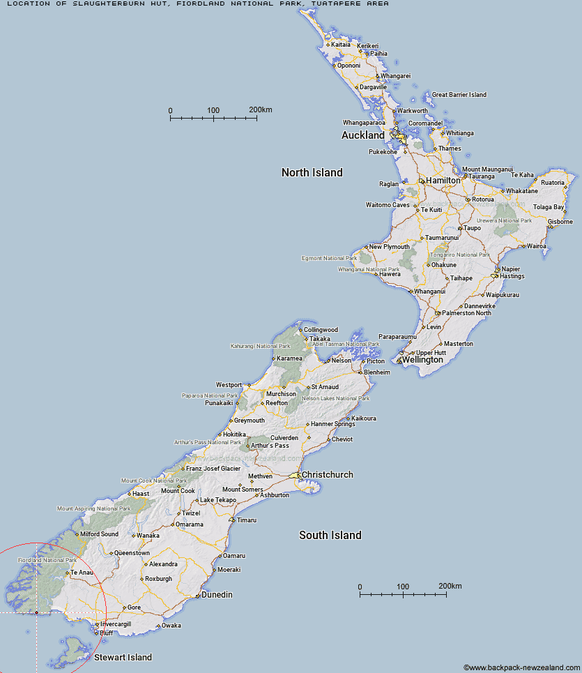
Topo Map showing location of Slaughterburn Hut
This information is sourced from DoC, LINZ and Openstreetmap. Some of the hut photos are mine and the rest are from DoC. I will be adding an upload feature soon so people can photos of .Slaughterburn Hut.
Basic info: basic 6-bunk hut located beside the Waitutu River.
Latitude: -46.1922144951
Longitude: 167.066213545
Location: Fiordland National Park, Tuatapere area
Area: Fiordland
Type of Hut: Basic/bivvies
Map: C46 Topo Map | Road Map
Does this hut still exist? Have any more information? Contact
Basic info: basic 6-bunk hut located beside the Waitutu River.
Latitude: -46.1922144951
Longitude: 167.066213545
Location: Fiordland National Park, Tuatapere area
Area: Fiordland
Type of Hut: Basic/bivvies
Map: C46 Topo Map | Road Map
Does this hut still exist? Have any more information? Contact
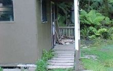
Image: DoC
Scroll down to see a topographical map and road map showing the location of Slaughterburn Hut
[ A ] [ B ] [ C ] [ D ] [ E ] [ F ] [ G ] [ H ] [ I ] [ J ] [ K ] [ L ] [ M ] [ N ] [ O ] [ P ] [ Q ] [ R ] [ S ] [ T ] [ U ] [ V ] [ W ] [ Y ] [ Z ]
Closest 20 Huts to Slaughterburn Hut
These are as the crow fliesWaitutu Hut 5km Westies Hut 9.12km Lake Poteriteri Hut 11.26km Wairaurahiri Hut 13.5km Okaka Lodge 19.16km Percy Burn Hut 19.18km Teal Bay Hut 22.48km Port Craig School Hut 22.97km Port Craig Lodge 22.98km Te Oneroa Hut 31.31km Caroline Hut 32.54km Hauroko Burn Hut 40.67km Eel Creek Hut 41.33km Monowai Hut 45.41km Rodger Inlet Huts 47.25km Halfway Hut 48.45km Clark Hut - A Frame 48.95km Historic Clark Hut 49.35km Green Lake Hut 52.06km Lake Roe Hut 54.67km Supper Cove Hut 55.29km Borland Bivouac 55.55km Loch Maree Hut 56.41km Turnbull's (Big Dam) Hut 61.46km Martin's Hut 61.58km Kintail Hut 64.34km North Borland Hut 64.99km Upper Spey Hut 68.46km Percy Shelter 69.95km Barcoo Hut 71.5km Rock Hut 74.67km West Arm Hut 75.68km Hope Arm Hut 76.41km Back Valley Hut 76.94km Telford Hut 77.62km East Ruggedy Hut 78.76km Redcliff Hut 78.78km Long Harry Hut 79.65km Upper Wairaki Hut 81.44km Lower Wairaki Hut 81.67km