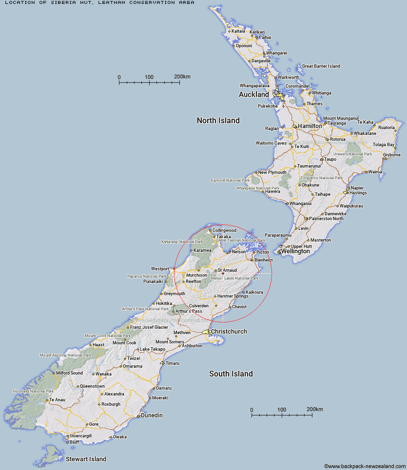
Topo Map showing location of Siberia Hut
This information is sourced from DoC, LINZ and Openstreetmap. Some of the hut photos are mine and the rest are from DoC. I will be adding an upload feature soon so people can photos of .Siberia Hut.
Basic info: standard 6-bunk hut in the South Marlborough area.
Latitude: -41.8793063261
Longitude: 173.074992127
Location: Leatham Conservation Area
Area: Marlborough
Type of Hut: Standard
Map: BS25 Topo Map | Road Map
Does this hut still exist? Have any more information? Contact
Basic info: standard 6-bunk hut in the South Marlborough area.
Latitude: -41.8793063261
Longitude: 173.074992127
Location: Leatham Conservation Area
Area: Marlborough
Type of Hut: Standard
Map: BS25 Topo Map | Road Map
Does this hut still exist? Have any more information? Contact
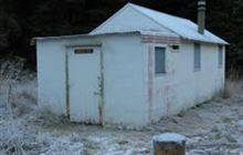
Image: DoC
Scroll down to see a topographical map and road map showing the location of Siberia Hut
[ A ] [ B ] [ C ] [ D ] [ E ] [ F ] [ G ] [ H ] [ I ] [ J ] [ K ] [ L ] [ M ] [ N ] [ O ] [ P ] [ Q ] [ R ] [ S ] [ T ] [ U ] [ V ] [ W ] [ Y ] [ Z ]
Closest 20 Huts to Siberia Hut
These are as the crow fliesSiberia Hut 0km Bottom Misery Hut 4.14km Lost Stream Bivouac 4.44km Greigs Hut 5.37km Mid Silverstream Hut 6.43km Top Misery Hut 6.71km Bottom Gordons Hut 7.52km Barbers Hut 7.98km Bull Paddock Creek Hut 8.35km Silverstream Bivouac 9.88km Branch Bivouac 9.89km Top Leatham Hut 10.45km Lees Creek Hut 10.92km Top Gordon Hut 11.54km Caves Hut 12.51km Team Hut 17.54km Red Hills Hut 17.86km Boulder Forks Hut 17.87km Junction Hut 20.26km Severn Hut 20.54km Saxton Hut 20.61km Blue Mountain Hut 20.7km Burnt Yards Hut 20.88km Lakehead Hut 20.94km Connors Creek Hut 21.05km Munroe Hut 21.3km Coldwater Hut 21.38km Bushline Hut 21.38km Beebys Hut 21.42km Bushedge Shelter 22.52km Relax Shelter 22.56km Carters Yards Hut 23.13km Hidden Hut 24km Turkeys Nest Bivouac 25.19km Gosling Hut 25.35km Porters Creek Hut 25.91km Acheron Hut 26.86km Speargrass Hut 26.89km Hopeless Hut 26.96km Angelus Hut 27.03km