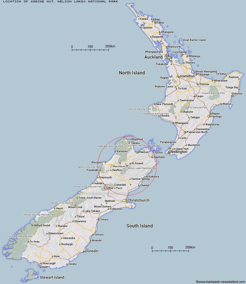
Topo Map showing location of Sabine Hut
This information is sourced from DoC, LINZ and Openstreetmap. Some of the hut photos are mine and the rest are from DoC. I will be adding an upload feature soon so people can photos of .Sabine Hut.
Basic info: serviced 32-bunk hut in the Nelson Lakes area.
Latitude: -41.9010982267
Longitude: 172.681312247
Location: Nelson Lakes National Park
Area: Nelson/Tasman
Type of Hut: Serviced
Tracks: Travers-Sabine Circuit
Map: BS24 Topo Map | Road Map
Does this hut still exist? Have any more information? Contact
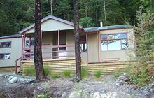
Image: DoC
Scroll down to see a topographical map and road map showing the location of Sabine Hut
[ A ] [ B ] [ C ] [ D ] [ E ] [ F ] [ G ] [ H ] [ I ] [ J ] [ K ] [ L ] [ M ] [ N ] [ O ] [ P ] [ Q ] [ R ] [ S ] [ T ] [ U ] [ V ] [ W ] [ Y ] [ Z ]
Closest 20 Huts to Sabine Hut
These are as the crow fliesD'Urville Hut 2.94km Mount Misery Hut 3.78km Angelus Hut 5.75km Hopeless Hut 7.03km Speargrass Hut 8.03km Tiraumea Hut 8.27km Cupola Hut 8.95km Morgan Hut 9.99km John Tait Hut 10.92km Mole Hut 11.25km Coldwater Hut 11.74km West Sabine Hut 11.88km Lakehead Hut 11.99km Relax Shelter 12.89km Bushedge Shelter 13.22km Bushline Hut 13.76km Upper Travers Hut 14.42km George Lyon Hut 17.45km Blue Lake Hut 17.61km Begley Hut 17.7km Matakitaki Base Hut 18.47km Connors Creek Hut 20.46km Upper D'Urville Hut 23.87km Paske Hut 24.17km Lees Creek Hut 24.73km Top Misery Hut 25.97km Bull Paddock Creek Hut 27.16km Caroline Creek Bivouac 28.13km Lost Stream Bivouac 28.7km Downie Hut 28.87km Beebys Hut 28.94km Island Gully Hut 29.77km Nardoo Hut 30.07km Branch Bivouac 30.24km Bottom Misery Hut 30.5km Mid Silverstream Hut 31.52km Sedgemere Sleepout 31.7km Red Hills Hut 31.91km Silverstream Bivouac 32.17km Siberia Hut 32.68km