New Zealand Backcountry Huts
Huts in New Zealand Beginning with B
These are a mixture of Department of Conservation and private huts. Those without much information are more than likely privately owned and may or maynot be open to the public. If anyone has any information on any of them it would be great if you contacted me and let me know.
The price of a serviced hut is $15 a night, standard hut is $5 a night, Basic/Bivvy are free or you can get an annual pass for $122. All these prices are half price for 11-17 year olds or free if 10 years old and under. The Great Walk huts vary from place to place and season to season but to give you an idea it is $140 a night on the Milford (half price for New Zealanders) to $15 off season and for summer at least they need to be booked through DoC which you can do online @ DoC. I do plan to add the tracks that these huts are on but it is proving to be complicated.
On each individual hut page I have included a zoomable topo map as well as a road map. Most of the information on these hut has been sourced from LINZ and DoC, so thanks to those two government departments :).
| Name | Latitude | Longitude | Area | Type | Photo | |
|---|---|---|---|---|---|---|
| Blue Lake Hut | -42.0582649991 | 172.655120243 | Nelson Lakes National Park | Serviced |  | Map |
| Blue Lake Huts | -45.4797487606 | 168.938383163 | Map | |||
| Blue Mountain Hut | -41.8627128678 | 173.324024231 | Glazebrook Conservation Area | Standard |  | Map |
| Blue Range Hut | -40.7933266504 | 175.518679884 | Tararua Forest Park | Standard |  | Map |
| Blue River (Blowfly) Hut | -43.7926665567 | 169.345854605 | Haast, Paringa and Moeraki rivers area | Standard |  | Map |
| Bluff Hut | -43.0467818695 | 171.126903716 | Kokatahi River - Whitcombe River area | Standard |  | Map |
| Blyth Hut | -39.3317959083 | 175.525054793 | Tongariro National Park | Serviced |  | Map |
| Boar Inn | -41.3456315882 | 174.969409728 | Catchpool Valley & Orongorongo Valley, Remutaka Forest Park | Serviced |  | Map |
| Boatshed Hut | -44.7378678573 | 167.80212922 | Map | |||
| Boatshed Shelter | -44.7378454875 | 167.801579976 | Map | |||
| Bob's Camp Bivouac | -43.1421722312 | 172.291501586 | Map | |||
| Bob's Hut | -39.3638564875 | 175.983319206 | Map | |||
| Bobs Hut | -42.2237440759 | 172.486152484 | Nelson Lakes National Park | Standard |  | Map |
| Bog Hut | -45.2121580424 | 170.633551094 | Map | |||
| Bog Inn Hut | -38.5831653578 | 175.628806549 | Pureora Forest Park | Standard |  | Map |
| Bonnie Jean Hut | -44.8591739216 | 168.449242412 | Map | |||
| Boo Boo Hut | -42.9282897037 | 171.198445362 | Kokatahi River - Whitcombe River area | Basic/bivvies |  | Map |
| Borland Bivouac | -45.7399179434 | 167.371384153 | Map | |||
| Bottom Gordons Hut | -41.9270265641 | 173.13932471 | Map | |||
| Bottom Misery Hut | -41.9113971987 | 173.049592246 | Leatham Conservation Area | Standard |  | Map |
| Bottom Mount Peel Hut | -43.8484265554 | 171.118831812 | Map | |||
| Boulder Forks Hut | -41.7900292751 | 173.25437065 | Leatham Conservation Area | Standard |  | Map |
| Boulder Lake Hut | -40.8999619516 | 172.578854005 | Kahurangi National Park | Standard |  | Map |
| Boundary Creek Hut | -44.7287304288 | 169.85485346 | Oteake Conservation Park | Standard |  | Map |
| Boundary Creek Hut | -43.5295253422 | 171.071437104 | Hakatere Conservation Park | Basic/bivvies |  | Map |
| Boundary Hut | -45.3298979841 | 169.145175896 | Old Woman and Old Man/Kopuwai Ranges | Basic/bivvies | 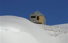 | Map |
| Boundary Hut | -45.1397205324 | 168.179583165 | Mavora Lakes Conservation Park | Standard | 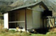 | Map |
| Boundary Hut | -44.2407517918 | 169.466610154 | Map | |||
| Boyle Flat Hut | -42.4655339595 | 172.460635412 | St James Conservation Area | Serviced | 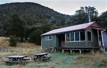 | Map |
| Branch Bivouac | -41.9636323502 | 173.037072572 | Map | |||
| Branch Creek Hut | -41.5238601305 | 172.510872269 | Kahurangi National Park | Standard | 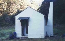 | Map |
| Brass Monkey Bivouac | -42.4194167631 | 172.316038893 | Map | |||
| Brewster Hut | -44.0878171212 | 169.412269362 | Makarora area, Mount Aspiring National Park | Serviced Alpine |  | Map |
| Briens Hut | -39.6661876674 | 176.340840843 | Map | |||
| Brills Bivouac | -38.1918373222 | 177.332133398 | Map | |||
| Brod Bay Shelter and Campsite | -45.4047079254 | 167.674515214 | Map | |||
| Brodrick Hut | -43.9750043667 | 169.728846576 | Ruataniwha Conservation Park | Standard |  | Map |
| Broken River Hut | -43.1897609545 | 171.836163078 | Korowai/Torlesse Tussocklands Park | Basic/bivvies |  | Map |
| Brown Hut | -44.8884676873 | 170.264863701 | Oteake Conservation Park | Basic/bivvies | Map | |
| Brown Hut | -40.8503933464 | 172.447283414 | Kahurangi National Park | Great Walk |  | Map |
| Browning Hut | -41.4137700944 | 173.276772502 | Mount Richmond Forest Park | Standard | 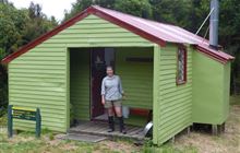 | Map |
| Browning Range Bivouac | -42.9053696307 | 171.274927983 | Map | |||
| Buckland Peaks Hut | -41.8744587083 | 171.629030489 | Map | |||
| Bull Creek Hut | -42.893126052 | 171.968329474 | Arthur's Pass National Park | Basic/bivvies | 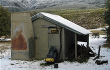 | Map |
| Bull Flat Hut | -44.1579939039 | 169.538009153 | Hāwea Conservation Park | Basic/bivvies | 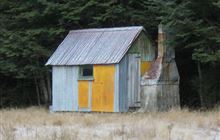 | Map |
| Bull Paddock Creek Hut | -41.8325507253 | 172.99614261 | Map | |||
| Bullendale Hut | -44.787579301 | 168.673524276 | Skippers area | Standard | 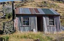 | Map |
| Bungaree Hut | -46.8090446308 | 168.033550157 | Rakiura National Park, Stewart Island/Rakiura | Standard | 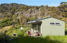 | Map |
| Burn Creek Hut | -42.1566545655 | 172.449162433 | Nelson Lakes National Park | Basic/bivvies | 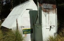 | Map |
| Burn Hut | -40.6203319107 | 175.528603443 | Tararua Forest Park | Basic/bivvies | 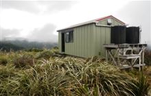 | Map |
[ A ] [ B ] [ C ] [ D ] [ E ] [ F ] [ G ] [ H ] [ I ] [ J ] [ K ] [ L ] [ M ] [ N ] [ O ] [ P ] [ Q ] [ R ] [ S ] [ T ] [ U ] [ V ] [ W ] [ Y ] [ Z ]