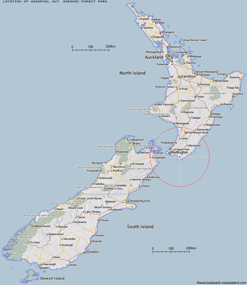
Topo Map showing location of Washpool Hut
This information is sourced from DoC, LINZ and Openstreetmap. Some of the hut photos are mine and the rest are from DoC. I will be adding an upload feature soon so people can photos of .Washpool Hut.
Basic info: standard six-bunk hut in the Wairarapa region.
Latitude: -41.477177905
Longitude: 175.292393819
Location: Aorangi Forest Park
Area: Wairarapa
Type of Hut: Standard
Tracks: Aorangi Crossing
Map: BR33 Topo Map | Road Map
Does this hut still exist? Have any more information? Contact
Basic info: standard six-bunk hut in the Wairarapa region.
Latitude: -41.477177905
Longitude: 175.292393819
Location: Aorangi Forest Park
Area: Wairarapa
Type of Hut: Standard
Tracks: Aorangi Crossing
Map: BR33 Topo Map | Road Map
Does this hut still exist? Have any more information? Contact
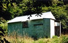
Image: DoC
Scroll down to see a topographical map and road map showing the location of Washpool Hut
[ A ] [ B ] [ C ] [ D ] [ E ] [ F ] [ G ] [ H ] [ I ] [ J ] [ K ] [ L ] [ M ] [ N ] [ O ] [ P ] [ Q ] [ R ] [ S ] [ T ] [ U ] [ V ] [ W ] [ Y ] [ Z ]
Closest 20 Huts to Washpool Hut
These are as the crow fliesPararaki Hut 2.99km Sutherlands Hut 5.57km Kawakawa Hut 5.96km Tauanui Hut 10km Mangatoetoe Hut 10.47km Wharepapa Hut 24.8km Papatahi Hut 28.42km Waiorongomai Hut 29.02km Haurangi Hut 29.66km Barneys Whare 29.78km Jans Hut 29.95km Waerenga Hut 30.27km Boar Inn 30.65km Paua Hut 30.78km Smith Creek Shelter 47.05km Eastern Hutt Hut 51.36km Tutuwai Hut 52km Waiohine Shelter 52.86km Alpha Hut 54.65km Cone Hut 54.65km Elder Hut 56.41km Renata Hut 57.46km Kime Hut 59.44km Sayer Hut 59.62km Waiotauru Hut 60.5km Neill Forks Hut 60.77km Totara Flats Hut 61.25km Maungahuka Hut 62.91km Kapakapanui Hut 63.34km Field Hut 63.38km Penn Creek Hut 64.01km Aokaparangi Hut 65.33km Mountain House Shelter 65.82km Powell Hut 66.78km Mid Waiohine Hut 67.48km Atiwhakatu Hut 69.06km Anderson Memorial Hut 70.33km Jumbo Hut 70.35km Waitewaewae Hut 71.86km McGregor Bivouac 72.35km