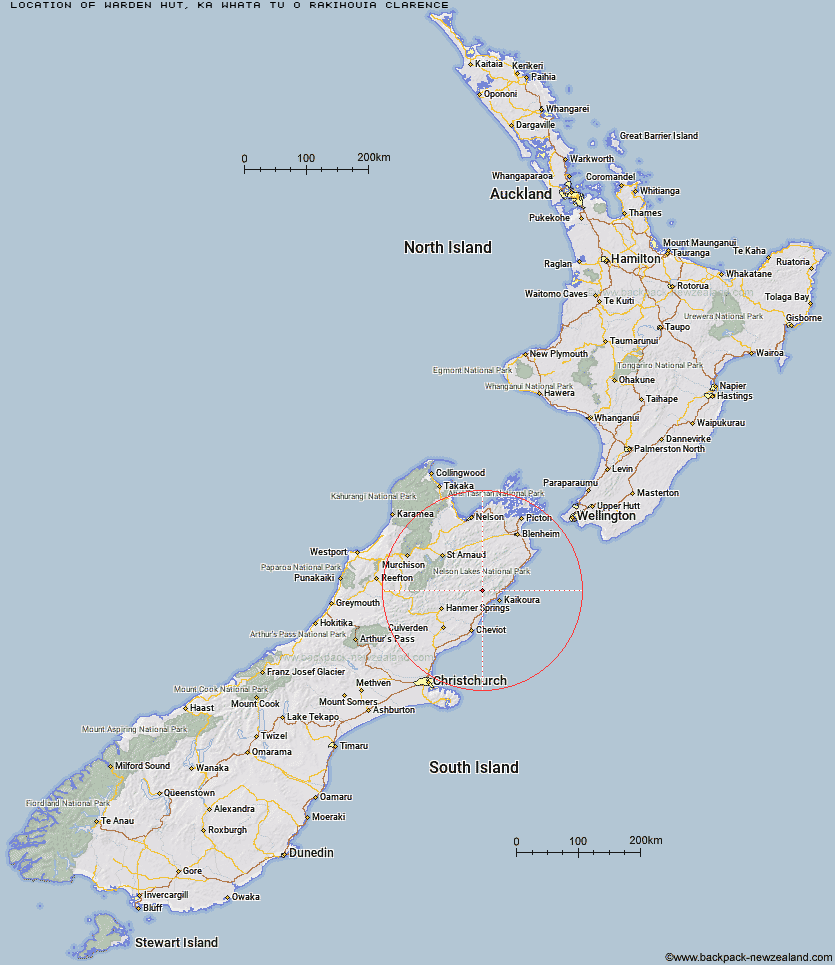
Topo Map showing location of Warden Hut
This information is sourced from DoC, LINZ and Openstreetmap. Some of the hut photos are mine and the rest are from DoC. I will be adding an upload feature soon so people can photos of .Warden Hut.
Basic info: standard 12-bunk hut in the South Marlborough hut.
Latitude: -42.2786233776
Longitude: 173.438497873
Location: Ka Whata Tu o Rakihouia Clarence
Area: Marlborough
Type of Hut: Standard
Map: BT27 Topo Map | Road Map
Does this hut still exist? Have any more information? Contact
Basic info: standard 12-bunk hut in the South Marlborough hut.
Latitude: -42.2786233776
Longitude: 173.438497873
Location: Ka Whata Tu o Rakihouia Clarence
Area: Marlborough
Type of Hut: Standard
Map: BT27 Topo Map | Road Map
Does this hut still exist? Have any more information? Contact
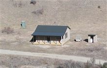
Image: DoC
Scroll down to see a topographical map and road map showing the location of Warden Hut
[ A ] [ B ] [ C ] [ D ] [ E ] [ F ] [ G ] [ H ] [ I ] [ J ] [ K ] [ L ] [ M ] [ N ] [ O ] [ P ] [ Q ] [ R ] [ S ] [ T ] [ U ] [ V ] [ W ] [ Y ] [ Z ]
Closest 20 Huts to Warden Hut
These are as the crow fliesBlack Spur Historic Hut 1.03km Tent Poles Hut 1.67km Kahutara Bivouac 5.46km Seymour Hut 7.1km Limestone Hut 7.3km Alfred Hut 9.01km Dubious Bivouac 12.31km Kowhai Hut 13.07km Mt Fyffe Hut 13.71km Lake McRae Hut 14.43km Palmer Hut 14.7km Palmer Bivouac 16.29km Goose Flat Hut 16.93km Stone Jug Hut 17.37km Hapuku Hut 17.54km Fidgit Bivouac 19.41km Barratts Hut 19.58km Barratts Bivouac 19.61km Half Moon Hut 24.62km Cloudy Hut 24.83km Haycocks Bivouac 27.71km Ravine Hut 28.11km Guide Hut 30.17km Jam Hut 30.56km Carters Yards Hut 30.97km Acheron Hut 31.84km Munroe Hut 32.76km Junction Hut 33.35km Saxton Hut 34.24km Hornby Bivvy 34.64km Old Middlehurst Hut 35.29km Snowgrass Hut 35.36km Red Gate Hut 35.68km Team Hut 36.28km Yarra Hut 36.36km Burnt Yards Hut 36.76km Dee Hut 40.25km Severn Hut 40.95km Gibson Hut 43.14km Top Gordon Hut 43.48km