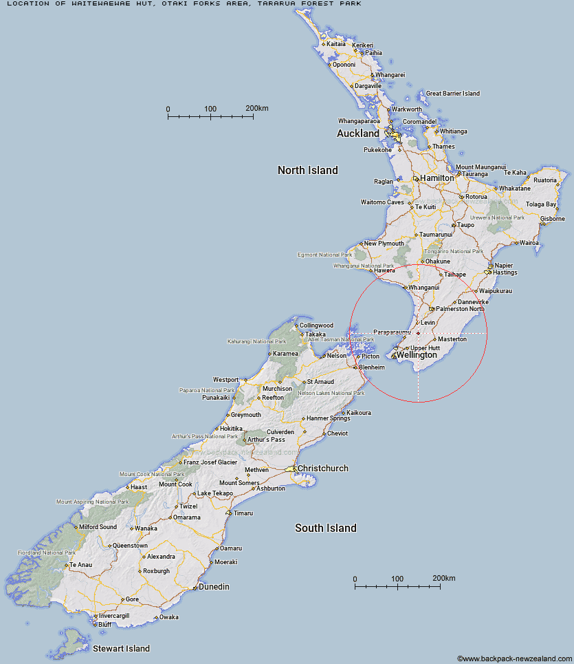
Topo Map showing location of Waitewaewae Hut
This information is sourced from DoC, LINZ and Openstreetmap. Some of the hut photos are mine and the rest are from DoC. I will be adding an upload feature soon so people can photos of .Waitewaewae Hut.
Basic info: standard 16-bunk hut in the Kapiti region.
Latitude: -40.8309742495
Longitude: 175.306236647
Location: Otaki Forks area, Tararua Forest Park
Area: Wellington/Kapiti
Type of Hut: Standard
Tracks: Waitewaewae Hut Track
Map: BP33 Topo Map | Road Map
Does this hut still exist? Have any more information? Contact
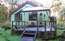
Image: DoC
Scroll down to see a topographical map and road map showing the location of Waitewaewae Hut
[ A ] [ B ] [ C ] [ D ] [ E ] [ F ] [ G ] [ H ] [ I ] [ J ] [ K ] [ L ] [ M ] [ N ] [ O ] [ P ] [ Q ] [ R ] [ S ] [ T ] [ U ] [ V ] [ W ] [ Y ] [ Z ]
Closest 20 Huts to Waitewaewae Hut
These are as the crow fliesAnderson Memorial Hut 4.53km Nichols Hut 6.3km Mid Waiohine Hut 7.94km Penn Creek Hut 8.02km Aokaparangi Hut 8.16km McGregor Bivouac 8.81km Carkeek Hut 8.83km Maungahuka Hut 9.34km Field Hut 9.52km Dracophyllum Hut 9.77km Dorset Ridge Hut 10.12km Jumbo Hut 11.53km Powell Hut 11.59km Tarn Ridge Hut 11.8km Mid King Bivouac 11.97km Neill Forks Hut 12.07km Waiopehu Hut 12.39km Mountain House Shelter 12.7km Kime Hut 12.77km Te Matawai Hut 12.98km Atiwhakatu Hut 13.1km Waikawa Shelter 13.22km Totara Flats Hut 13.94km Arete Hut 14.33km South Ohau Hut 14.4km Mitre Flats Hut 14.52km Arete Forks Hut 14.54km Sayer Hut 14.82km Waiotauru Hut 15.74km Kapakapanui Hut 15.88km Cow Creek Hut 16.68km Elder Hut 16.85km North Ohau Hut 16.97km Alpha Hut 17.33km Cone Hut 17.68km Blue Range Hut 18.36km Dundas Hut 18.52km Mangahao Flats Hut 18.94km Renata Hut 18.96km Tutuwai Hut 19.99km