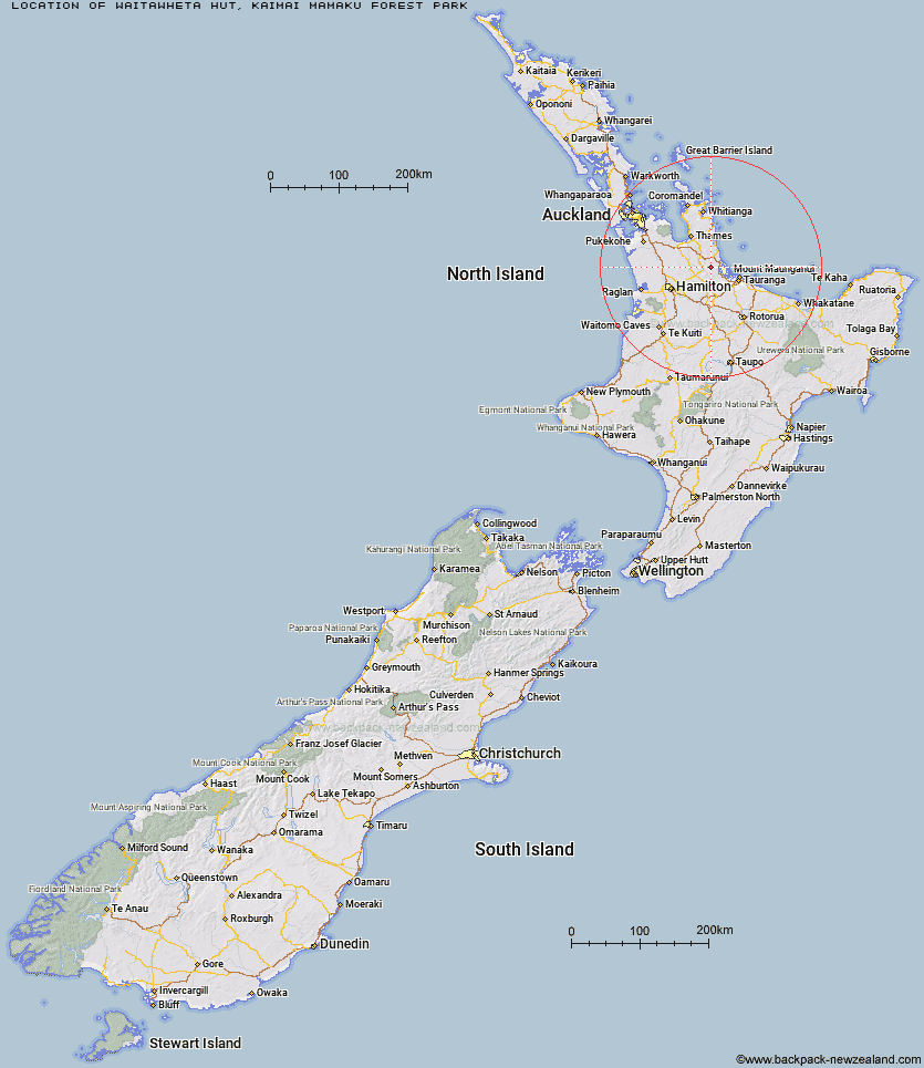
Topo Map showing location of Waitawheta Hut
This information is sourced from DoC, LINZ and Openstreetmap. Some of the hut photos are mine and the rest are from DoC. I will be adding an upload feature soon so people can photos of .Waitawheta Hut.
Basic info: serviced 26-bunk hut in the Tauranga area. The hut must be booked online in advance. No booking is required for camping.
Latitude: -37.5262775206
Longitude: 175.806301842
Location: Kaimai Mamaku Forest Park
Area: Bay of Plenty
Type of Hut: Serviced
Tracks: Waitawheta Tramway|North-South Track
Map: BC35 Topo Map | Road Map
Does this hut still exist? Have any more information? Contact
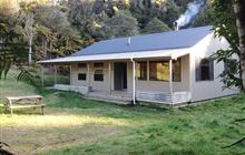
Image: DoC
Scroll down to see a topographical map and road map showing the location of Waitawheta Hut
[ A ] [ B ] [ C ] [ D ] [ E ] [ F ] [ G ] [ H ] [ I ] [ J ] [ K ] [ L ] [ M ] [ N ] [ O ] [ P ] [ Q ] [ R ] [ S ] [ T ] [ U ] [ V ] [ W ] [ Y ] [ Z ]
Closest 20 Huts to Waitawheta Hut
These are as the crow fliesWairoa Shelter 3.77km Mangakino Shelter 5.13km Daly's Clearing Hut 6.01km Te Rereatukahia Hut 6.99km Motutapere Hut 11.07km Kauritatahi Hut 16.17km Ngamuwahine Shelter 29.51km Mangamuka Hut 30.15km Hurunui Hut 34.12km Pinnacles Hut 54.48km Crosbies Hut 56.39km Piggotts Hut 74.82km Pahautea Hut 81.5km Wairua Hut 96.06km Wildlife Hut 99.56km Hamilton Tomo Group Hut 102.4km Bog Inn Hut 118.54km Waihua Hut 126.45km Mangamako Hut 128.23km Twain (Waipotiki) Hut 128.57km Saddle (Mangaawai) Hut 129.69km Casino Hut 130.49km Waihaha Hut 131.2km Apiti Hut 131.83km Duckville Hut 132.27km Horomanga Base Camp 132.95km Ongaruanuku Hut 133.15km Wharekahika Hut 134.48km Leitchs Hut 135.14km Ohora Hut 137.74km Hauhungaroa Hut 138.32km Manaohou Right Branch Hut 138.61km Okui Hut 140.6km Onepu Hut 141.51km Waikare Junction Hut 142.31km Hanamahihi Hut 142.49km Mangapouri Hut 143.8km Ohane Hut 144.91km Ngahiramai Hut 148.56km Takurua Hut 149.41km