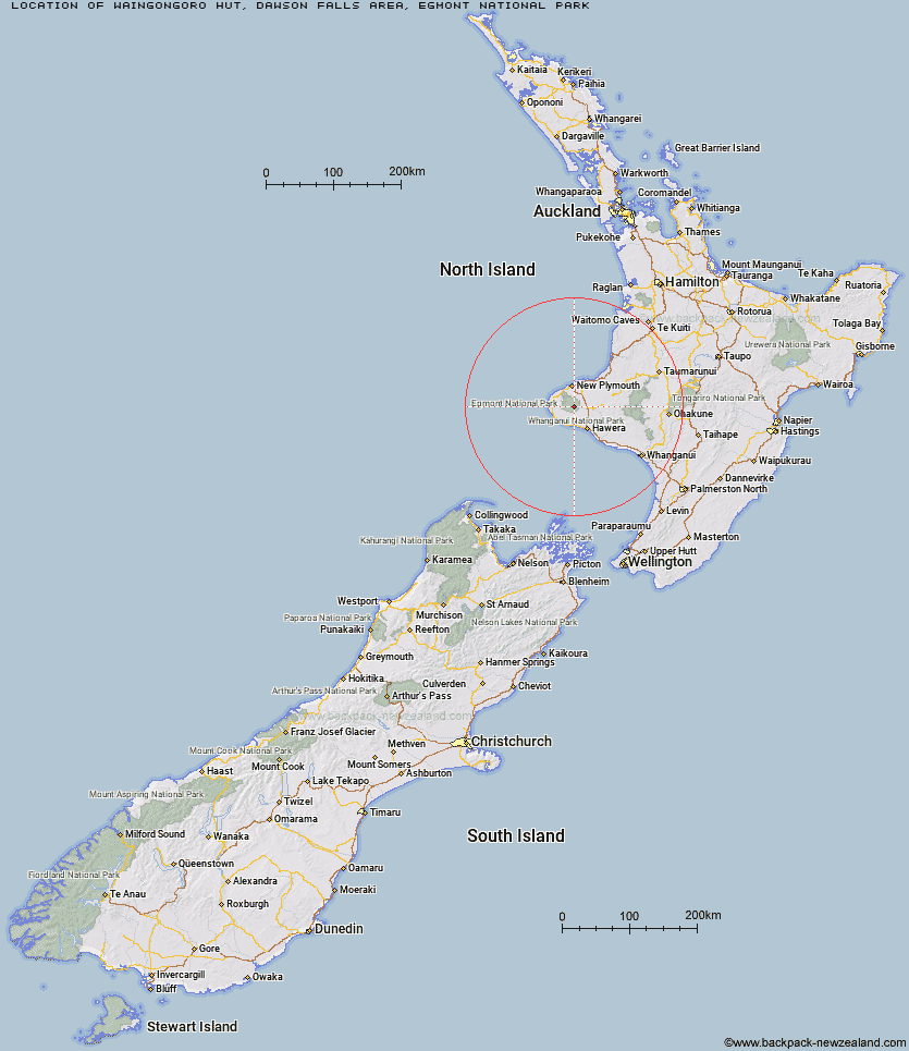
Topo Map showing location of Waingongoro Hut
This information is sourced from DoC, LINZ and Openstreetmap. Some of the hut photos are mine and the rest are from DoC. I will be adding an upload feature soon so people can photos of .Waingongoro Hut.
Basic info: This hut is a great half day tramp or overnight tramp for families with children and new trampers.
Latitude: -39.318736794
Longitude: 174.110449048
Location: Dawson Falls area, Egmont National Park
Area: Taranaki
Type of Hut: Serviced
Tracks: Waingongoro Hut tracks
Map: BJ29 Topo Map | Road Map
Does this hut still exist? Have any more information? Contact
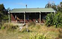
Image: DoC
Scroll down to see a topographical map and road map showing the location of Waingongoro Hut
[ A ] [ B ] [ C ] [ D ] [ E ] [ F ] [ G ] [ H ] [ I ] [ J ] [ K ] [ L ] [ M ] [ N ] [ O ] [ P ] [ Q ] [ R ] [ S ] [ T ] [ U ] [ V ] [ W ] [ Y ] [ Z ]
Closest 20 Huts to Waingongoro Hut
These are as the crow fliesHooker Shelter 1.96km Syme Hut 3.96km Maketawa Hut 4.24km Lake Dive Hut 4.69km Holly Hut 8.07km Kahui Hut 8.69km Kaiauai Shelter 9.1km Waiaua Gorge Hut 9.21km Pouakai Hut 11.22km Waiweranui Trust Hut 13.72km Trains Hut 56.17km Omaru Hut 57.53km Tahupo Hut 58.47km Puteore Hut 58.68km Pouri Hut 63.75km Rerekapa Hut 67.83km Ngapurua Hut 68.86km John Coull Hut 69.77km Puketotara Hut 74.57km Tieke Kainga 75.95km Ohuraiti Hut 85.09km Downes hut 98.61km Leitchs Hut 114.31km Mangaturuturu Hut 119.73km Ten Man Hut 120.08km Lupton Hut 121.44km Whakapapaiti Hut 121.46km Blyth Hut 121.69km Mangaehuehu Hut 123.85km Whangaehu Hut 127.25km Mangatepopo Hut 129.46km Rangipo Hut 130.22km Ketetahi Shelter 134.94km Old Waihohonu Hut 135.04km Waihohonu Hut 135.65km Hauhungaroa Hut 137.07km Oturere Hut 137.13km Zekes Hut 142.71km Hamilton Tomo Group Hut 145.73km Waihaha Hut 146.26km