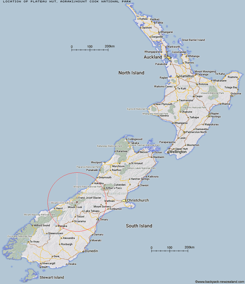
Topo Map showing location of Plateau Hut
This information is sourced from DoC, LINZ and Openstreetmap. Some of the hut photos are mine and the rest are from DoC. I will be adding an upload feature soon so people can photos of .Plateau Hut.
Basic info: This is an alpine serviced 33-bunk hut in the Aoraki/Mount Cook area.
Latitude: -43.5836498402
Longitude: 170.184025768
Location: Aoraki/Mount Cook National Park
Area: Canterbury
Type of Hut: Serviced Alpine
Map: BX16 Topo Map | Road Map
Does this hut still exist? Have any more information? Contact
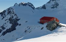
Image: DoC
Scroll down to see a topographical map and road map showing the location of Plateau Hut
[ A ] [ B ] [ C ] [ D ] [ E ] [ F ] [ G ] [ H ] [ I ] [ J ] [ K ] [ L ] [ M ] [ N ] [ O ] [ P ] [ Q ] [ R ] [ S ] [ T ] [ U ] [ V ] [ W ] [ Y ] [ Z ]
Closest 20 Huts to Plateau Hut
These are as the crow fliesHaast Hut 1.02km Ball Hut 4.6km Empress Hut 5.16km Pioneer Hut 5.81km Caroline Hut 5.89km Centennial Hut 9.31km Chancellor Hut 10.18km Onslow Hut (Steffan Memorial Hut) 10.3km Copland Shelter 10.51km Liebig Hut 11.36km Almer Hut 12.3km Sefton Bivvy 14.5km Stocking Stream Shelter 14.55km Castle Rocks Hut 14.58km Tasman Saddle Hut 14.91km Douglas Rock Hut 15.39km Kelman Hut 15.96km Hende's Hut 16.76km Spencer Rock Bivouac 17.74km Mueller Hut 18.01km Murchison Hut 18.43km Littles Hut 18.85km Memorial Hut 19.22km Birdcage Hut 19.8km Welcome Flat Campsite 19.81km Welcome Flat Hut 19.83km Harpers Rock Bivouac 21.41km Whymper Hut 21.83km Green Point Hut 23.4km Rankin Hut 23.59km Horace Walker Hut 24.09km Architect Creek Hut 24.16km Tin Hut 24.36km Barron Saddle Hut 24.46km Angus Hut 24.69km Eade Memorial Hut 25.05km Red Stag Hut 26.11km Christmas Flat Hut 26.74km Butler Junction Hut 26.98km Ryders Hut 27.13km