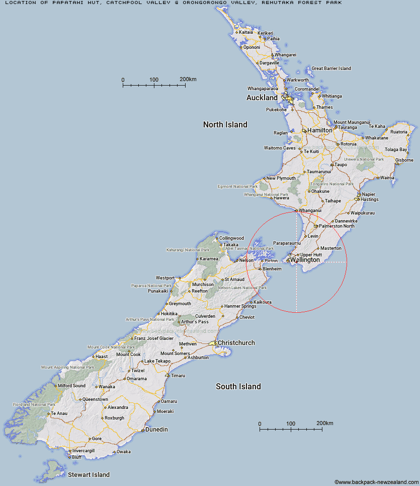
Topo Map showing location of Papatahi Hut
This information is sourced from DoC, LINZ and Openstreetmap. Some of the hut photos are mine and the rest are from DoC. I will be adding an upload feature soon so people can photos of .Papatahi Hut.
Basic info: serviced 10-bunk hut in the Wellington region. The hut is locked and must be booked in advance to gain access.
Latitude: -41.3238365939
Longitude: 175.019810274
Location: Catchpool Valley & Orongorongo Valley, Remutaka Forest Park
Area: Wellington/Kapiti
Type of Hut: Serviced
Tracks: Orongorongo Track|Big Bend Track
Map: BQ32 Topo Map | Road Map
Does this hut still exist? Have any more information? Contact
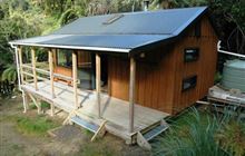
Image: DoC
Scroll down to see a topographical map and road map showing the location of Papatahi Hut
[ A ] [ B ] [ C ] [ D ] [ E ] [ F ] [ G ] [ H ] [ I ] [ J ] [ K ] [ L ] [ M ] [ N ] [ O ] [ P ] [ Q ] [ R ] [ S ] [ T ] [ U ] [ V ] [ W ] [ Y ] [ Z ]
Closest 20 Huts to Papatahi Hut
These are as the crow fliesHaurangi Hut 1.96km Jans Hut 3.7km Waerenga Hut 4.16km Wharepapa Hut 4.65km Boar Inn 4.86km Paua Hut 5.33km Waiorongomai Hut 10.41km Barneys Whare 12.26km Tauanui Hut 24.85km Washpool Hut 28.42km Sutherlands Hut 28.85km Pararaki Hut 30.92km Kawakawa Hut 32.4km Mangatoetoe Hut 34.5km Smith Creek Shelter 36.95km Eastern Hutt Hut 39.75km Renata Hut 41.55km Elder Hut 43km Tutuwai Hut 43.24km Alpha Hut 43.53km Waiotauru Hut 44.97km Cone Hut 46.27km Kapakapanui Hut 46.65km Waiohine Shelter 46.93km Kime Hut 47.33km Field Hut 50.32km Neill Forks Hut 51.81km Penn Creek Hut 52km Sayer Hut 52.38km Maungahuka Hut 52.79km Totara Flats Hut 54.06km Aokaparangi Hut 55.87km Mid Waiohine Hut 58.49km Mountain House Shelter 58.9km Powell Hut 59.42km Waitewaewae Hut 59.83km Anderson Memorial Hut 60.1km Atiwhakatu Hut 62.38km Jumbo Hut 62.96km McGregor Bivouac 63.69km