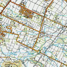
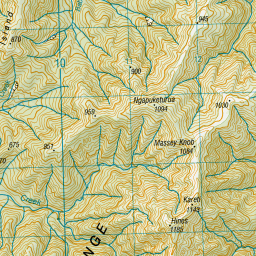
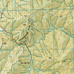
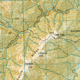
Topo Map showing location of North Ohau Hut
This information is sourced from DoC, LINZ and Openstreetmap. Some of the hut photos are mine and the rest are from DoC. I will be adding an upload feature soon so people can photos of .North Ohau Hut.
Basic info: basic four-bunk hut in the Kapiti area.
Latitude: -40.6969530097
Longitude: 175.402601594
Location: Tararua Forest Park
Area: Wellington/Kapiti
Type of Hut: Basic/bivvies
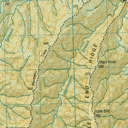
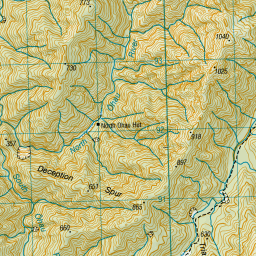
Map: BN33 Topo Map | Road Map
Does this hut still exist? Have any more information? Contact
Basic info: basic four-bunk hut in the Kapiti area.
Latitude: -40.6969530097
Longitude: 175.402601594
Location: Tararua Forest Park
Area: Wellington/Kapiti
Type of Hut: Basic/bivvies
Map: BN33 Topo Map | Road Map
Does this hut still exist? Have any more information? Contact
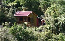
Image: DoC
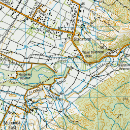
Scroll down to see a topographical map and road map showing the location of North Ohau Hut
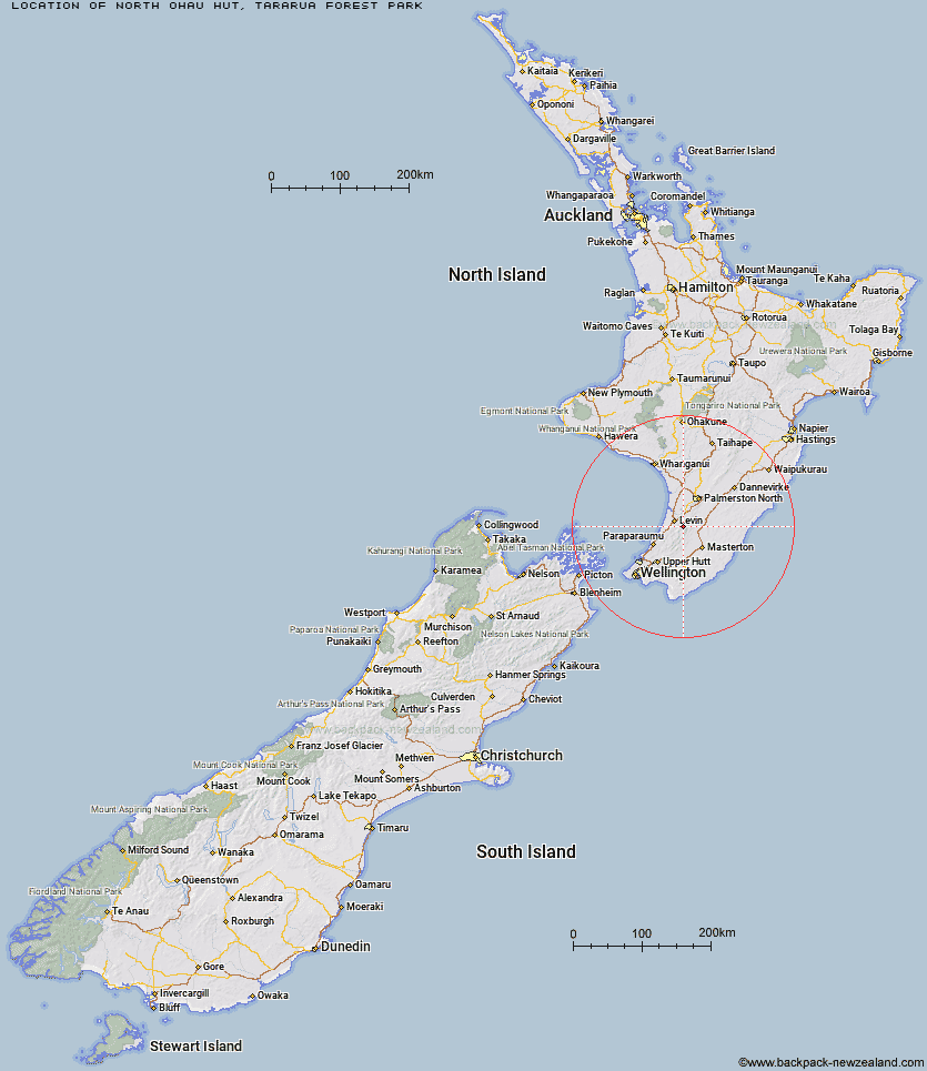
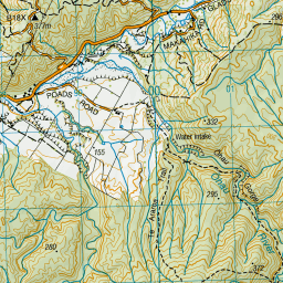
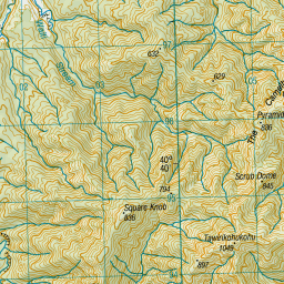
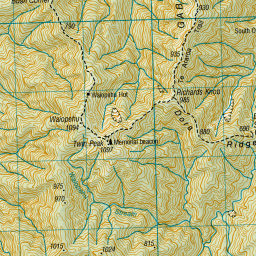
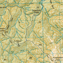
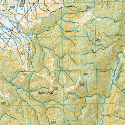
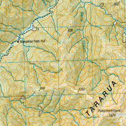
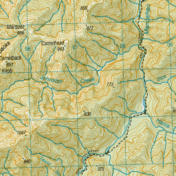
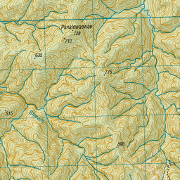
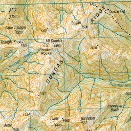
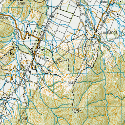
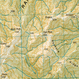

Leaflet | Sourced from LINZ. CC BY 4.0


Leaflet | Map data © OpenStreetMap contributors
[ A ] [ B ] [ C ] [ D ] [ E ] [ F ] [ G ] [ H ] [ I ] [ J ] [ K ] [ L ] [ M ] [ N ] [ O ] [ P ] [ Q ] [ R ] [ S ] [ T ] [ U ] [ V ] [ W ] [ Y ] [ Z ]
Closest 20 Huts to North Ohau Hut
These are as the crow fliesSouth Ohau Hut 2.58km Mangahao Flats Hut 2.87km Te Matawai Hut 4.52km Waiopehu Hut 5.05km Dundas Hut 5.77km Arete Hut 6.43km Dracophyllum Hut 8.16km Arete Forks Hut 8.8km Cattle Ridge Hut 9.26km Herepai Hut 10.18km Carkeek Hut 10.39km Tarn Ridge Hut 10.8km Roaring Stag Hut 10.94km Cow Creek Hut 11.59km Dorset Ridge Hut 12.41km Nichols Hut 12.8km Waikawa Shelter 13.38km Burn Hut 13.62km Blue Range Hut 14.51km Mid King Bivouac 15.01km McGregor Bivouac 15.11km Mitre Flats Hut 16.18km Waitewaewae Hut 16.97km Anderson Memorial Hut 17.08km Jumbo Hut 17.78km Atiwhakatu Hut 19.53km Mid Waiohine Hut 19.77km Powell Hut 20.97km Aokaparangi Hut 21.96km Mountain House Shelter 22.11km North Mangahao Bivouac 24.37km Maungahuka Hut 24.63km Penn Creek Hut 24.76km Totara Flats Hut 26.21km Field Hut 26.49km Neill Forks Hut 26.51km Sayer Hut 27.75km Kime Hut 29.48km Kapakapanui Hut 32.11km Waiotauru Hut 32.55km