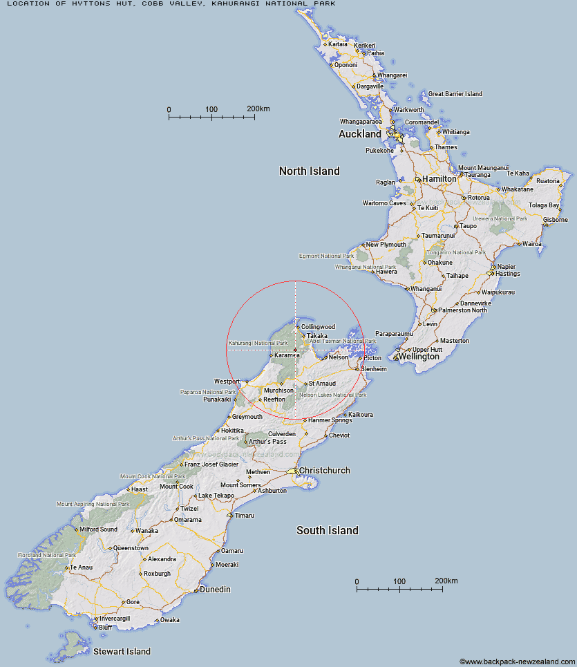
Topo Map showing location of Myttons Hut
This information is sourced from DoC, LINZ and Openstreetmap. Some of the hut photos are mine and the rest are from DoC. I will be adding an upload feature soon so people can photos of .Myttons Hut.
Basic info: basic 4-bunk hut in the Golden Bay area.
Latitude: -41.1357842705
Longitude: 172.621662185
Location: Cobb Valley, Kahurangi National Park
Area: Nelson/Tasman
Type of Hut: Basic/bivvies
Tracks: Lake Peel tracks
Map: Topo Map | Road Map
Does this hut still exist? Have any more information? Contact
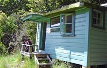
Image: DoC
Scroll down to see a topographical map and road map showing the location of Myttons Hut
[ A ] [ B ] [ C ] [ D ] [ E ] [ F ] [ G ] [ H ] [ I ] [ J ] [ K ] [ L ] [ M ] [ N ] [ O ] [ P ] [ Q ] [ R ] [ S ] [ T ] [ U ] [ V ] [ W ] [ Y ] [ Z ]
Closest 20 Huts to Myttons Hut
These are as the crow fliesTrilobite Hut 1.21km Balloon Hut 3.71km Sylvester Hut 3.81km Growler Rock Shelter 5.64km Dry Rock Shelter 5.67km Asbestos Cottage 5.92km Chaffey Hut 6.24km Upper Gridiron Hut and Rock Shelters 7.38km Splugeons Rock Shelter 7.81km Mt Arthur Hut 10.46km Flora Hut 10.46km Tent Camp 10.54km Waingaro Forks Hut 10.96km Cobb Hut 12.02km Fenella Hut 12.54km Ellis Hut 12.54km Karamea Bend Hut 14.24km Riordans Hut 14.28km Soper Shelter 14.55km Flanagans Hut 15.34km Roaring Lion Hut 17.19km Tin Hut Shelter 17.73km Lonely Lake Hut 17.85km Crow Hut 21.7km Anatoki Forks Hut 21.88km Adelaide Tarn Hut 22.46km Venus Hut 25.25km Boulder Lake Hut 26.47km Thor Hut 28.63km John Reid Hut 30.23km Greys Hut 31.15km Perry Saddle Hut 31.9km Kiwi Saddle Hut 31.98km Castle Rock Hut 33.92km Moa Park Shelter 34.32km Kākāpō Hut 34.43km Adams Flat Hut 34.92km Brown Hut 34.95km Trevor Carter Hut 34.99km Wainui Hut 35.13km