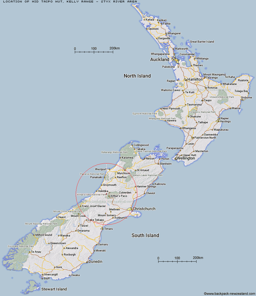
Topo Map showing location of Mid Taipo Hut
This information is sourced from DoC, LINZ and Openstreetmap. Some of the hut photos are mine and the rest are from DoC. I will be adding an upload feature soon so people can photos of .Mid Taipo Hut.
Basic info: standard six-bunk hut in the Hokitika area.
Latitude: -42.8500992265
Longitude: 171.443393263
Location: Kelly Range - Styx River area
Area: West Coast
Type of Hut: Standard
Tracks: Taipo River Track to Harman Pass|Harman Pass Route
Map: BV20 Topo Map | Road Map
Does this hut still exist? Have any more information? Contact
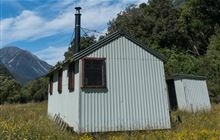
Image: DoC
Scroll down to see a topographical map and road map showing the location of Mid Taipo Hut
[ A ] [ B ] [ C ] [ D ] [ E ] [ F ] [ G ] [ H ] [ I ] [ J ] [ K ] [ L ] [ M ] [ N ] [ O ] [ P ] [ Q ] [ R ] [ S ] [ T ] [ U ] [ V ] [ W ] [ Y ] [ Z ]
Closest 20 Huts to Mid Taipo Hut
These are as the crow fliesDunns Creek Hut 2.1km Hunts Creek Hut 4.86km Scottys Bivouac 5.42km Newton Creek Hut 5.44km Julia Hut 5.5km Old Julia Hut 5.52km Mudflats Hut 6.69km Rocky Creek Bivouac 7.6km Griffin Creek Hut 7.63km Dillon Hut 7.95km Dillons Homestead Hut 8.15km Waimakariri Falls Hut 8.33km Campbell Bivouac 8.93km Top Olderog Bivouac 8.97km Carroll Hut 11.07km Lower Olderog Bivouac 11.28km Lower Arahura Hut 11.66km Crow Hut 11.99km Jacks Hut 12.17km Carrington Hut 12.21km Harman Hut 12.57km Grassy Flat Hut 13.19km Newton Range Bivouac 14.34km Upper Deception Hut 14.65km Browning Range Bivouac 15.04km Goat Pass Hut 15.86km Park Morpeth Hut 15.86km Barker Hut 15.88km Top Crawford Hut 16.42km Mid Styx Hut 16.93km Mingha Bivouac 17.22km Anti Crow Hut 17.53km Camp Creek Hut 18.69km Pfeifer Bivouac 18.83km Greyneys Shelter 19.12km Edwards Hut 19.54km Mt Brown Hut 19.94km Klondyke Shelter 20.67km Crawford Junction Hut 20.98km Boo Boo Hut 21.77km