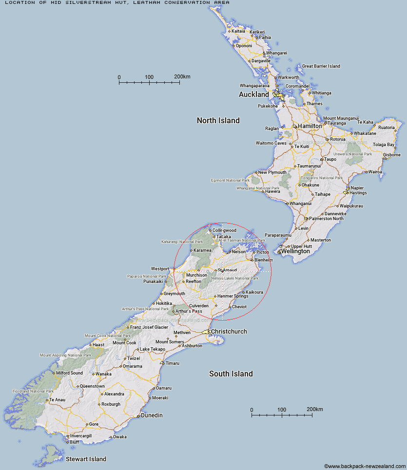
Topo Map showing location of Mid Silverstream Hut
This information is sourced from DoC, LINZ and Openstreetmap. Some of the hut photos are mine and the rest are from DoC. I will be adding an upload feature soon so people can photos of .Mid Silverstream Hut.
Basic info: standard 5-bunk hut in the South Marlborough area.
Latitude: -41.8251156396
Longitude: 173.047951165
Location: Leatham Conservation Area
Area: Marlborough
Type of Hut: Standard
Map: BS25 Topo Map | Road Map
Does this hut still exist? Have any more information? Contact
Basic info: standard 5-bunk hut in the South Marlborough area.
Latitude: -41.8251156396
Longitude: 173.047951165
Location: Leatham Conservation Area
Area: Marlborough
Type of Hut: Standard
Map: BS25 Topo Map | Road Map
Does this hut still exist? Have any more information? Contact
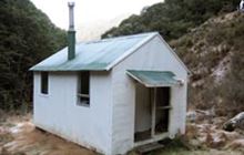
Image: DoC
Scroll down to see a topographical map and road map showing the location of Mid Silverstream Hut
[ A ] [ B ] [ C ] [ D ] [ E ] [ F ] [ G ] [ H ] [ I ] [ J ] [ K ] [ L ] [ M ] [ N ] [ O ] [ P ] [ Q ] [ R ] [ S ] [ T ] [ U ] [ V ] [ W ] [ Y ] [ Z ]
Closest 20 Huts to Mid Silverstream Hut
These are as the crow fliesMid Silverstream Hut 0km Silverstream Bivouac 3.51km Bull Paddock Creek Hut 4.37km Lost Stream Bivouac 4.89km Greigs Hut 4.91km Siberia Hut 6.43km Top Misery Hut 7.93km Bottom Misery Hut 9.6km Barbers Hut 10.9km Red Hills Hut 11.45km Caves Hut 11.96km Bottom Gordons Hut 13.63km Lees Creek Hut 14.47km Beebys Hut 15.24km Branch Bivouac 15.43km Top Leatham Hut 16.7km Top Gordon Hut 17.01km Boulder Forks Hut 17.55km Bushline Hut 18.66km Porters Creek Hut 19.53km Lakehead Hut 19.53km Bushedge Shelter 19.67km Coldwater Hut 19.78km Relax Shelter 19.81km Hidden Hut 22.64km Blue Mountain Hut 23.25km Top Wairoa Hut 23.94km Team Hut 23.95km Connors Creek Hut 24.15km Turkeys Nest Bivouac 24.31km Speargrass Hut 24.67km Gosling Hut 25.2km Hunters Hut 25.36km Angelus Hut 25.77km Lower Goulter Hut 25.91km Burnt Yards Hut 25.98km Severn Hut 26.34km Junction Hut 26.59km Hopeless Hut 26.81km Saxton Hut 27.03km