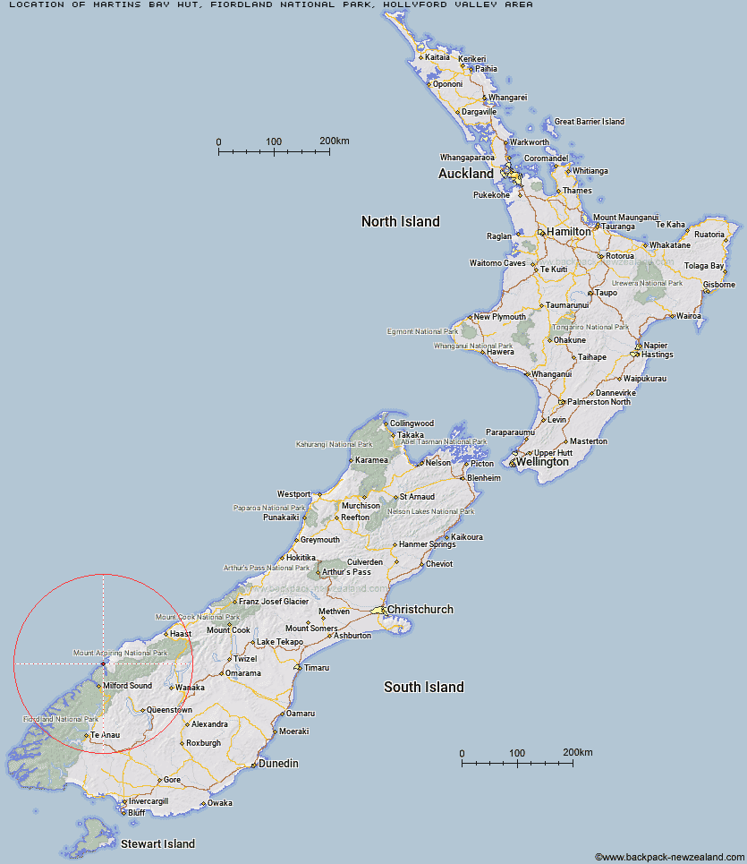
Topo Map showing location of Martins Bay Hut
This information is sourced from DoC, LINZ and Openstreetmap. Some of the hut photos are mine and the rest are from DoC. I will be adding an upload feature soon so people can photos of .Martins Bay Hut.
Basic info: serviced 24-bunk hut in northern Fiordland.
Latitude: -44.3346983226
Longitude: 168.002222624
Location: Fiordland National Park, Hollyford Valley area
Area: Fiordland
Type of Hut: Serviced
Tracks: Hollyford Track
Map: CA09 Topo Map | Road Map
Does this hut still exist? Have any more information? Contact
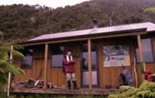
Image: DoC
Scroll down to see a topographical map and road map showing the location of Martins Bay Hut
[ A ] [ B ] [ C ] [ D ] [ E ] [ F ] [ G ] [ H ] [ I ] [ J ] [ K ] [ L ] [ M ] [ N ] [ O ] [ P ] [ Q ] [ R ] [ S ] [ T ] [ U ] [ V ] [ W ] [ Y ] [ Z ]
Closest 20 Huts to Martins Bay Hut
These are as the crow fliesMartins Bay Hut 0km Big Bay Hut 9.84km Hokuri Hut 10.53km Kaipo Hut 17.73km Demon Trail Hut 18.61km Olivine Hut 20.73km McKerrow Island Hut 20.95km Gorge River Hut 22.65km Lake Alabaster Hut 26.05km Pawnbroker Rock 28.4km Spoon Hut 30.97km Turners Bivouac 31.8km Hidden Falls Hut 33.33km Sunshine Hut 34.02km Daleys Flat Hut 37.9km Sandfly Point Shelter 39.68km Giant Gate Shelter 43.04km Gill's Bivvy 44.57km Esquilant Bivvy Hut 44.79km Phil's Bivvy 45.37km Routeburn Falls Hut 46.22km Routeburn Falls Lodge 46.24km Routeburn Flats Hut 46.64km Shelter Rock Hut 47.31km Boatshed Hut 47.55km Boatshed Shelter 47.57km Earnslaw Hut 47.61km Routeburn Shelter 48km Homer Hut 48.11km Dart Hut 48.53km Arawhata Rock Bivouac 48.95km Lake Mackenzie Hut 50.01km Lake Mackenzie Lodge 50.14km Twenty Five Mile Hut 50.37km Dumpling Hut 51.75km Liverpool Hut 53.77km Andersons Cascade Shelter 54.18km Quintin Lodge 54.47km Lake Howden Hut 54.5km Aspiring Hut 54.61km