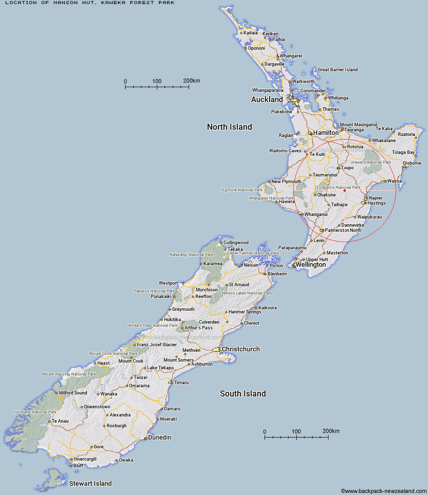
Topo Map showing location of Manson Hut
This information is sourced from DoC, LINZ and Openstreetmap. Some of the hut photos are mine and the rest are from DoC. I will be adding an upload feature soon so people can photos of .Manson Hut.
Basic info: Manson Hut is located in the lower central section of the area known as the “Manson Countryâ€.
Latitude: -39.2962061447
Longitude: 176.259935899
Location: Kaweka Forest Park
Area: Hawke's Bay
Type of Hut: Standard
Map: BJ37 Topo Map | Road Map
Does this hut still exist? Have any more information? Contact
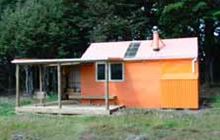
Image: DoC
Scroll down to see a topographical map and road map showing the location of Manson Hut
[ A ] [ B ] [ C ] [ D ] [ E ] [ F ] [ G ] [ H ] [ I ] [ J ] [ K ] [ L ] [ M ] [ N ] [ O ] [ P ] [ Q ] [ R ] [ S ] [ T ] [ U ] [ V ] [ W ] [ Y ] [ Z ]
Closest 20 Huts to Manson Hut
These are as the crow fliesOld Manson Hut 0.27km Manson Bivouac 2.47km Otutu Hut 3.42km Kiwi Mouth Hut 3.67km Rocks Ahead Bivouac 3.8km Rocks Ahead Hut 3.91km Otutu Island Hut 4.93km Rock Camp Bivouac 5.22km Omarukokere Bivouac 5.82km Back Ridge Bivouac 6.19km Kiwi Saddle Hut 6.66km Ngaawapurua Hut 6.96km Venison Tops Hut (Tira Lodge) 7.62km Cameron Hut 7.79km Back Ridge Hut 8.58km Studholme Saddle Bivouac 8.99km Studholme Saddle Hut 9km Mangaturutu Hut 10.47km Harkness Hut 11.35km Ballard Hut 11.46km Te Puke (Te Pukeohikarua) Hut 11.51km Dominie Hut 11.66km Golden Hills Hut 12.3km Mackintosh Hut 12.54km Makahu Saddle Hut 12.76km Kaweka Flats Bivouac 14.01km Tussock Hut 15.02km Iron Whare 15.35km Black Birch Bivouac 15.36km Middle Hill Hut 16.26km Te Apunga Hut 16.86km Mangatainoka Hut 17.07km Makino Hut 17.38km Lowry Shelter 18.17km Comet Hut 19.32km WTFRW Hut 21.87km Cedars Hut (Blowfly) 22.7km East Creek Hut 23.21km Te Matai Hut 23.76km Shutes Hut 24.14km