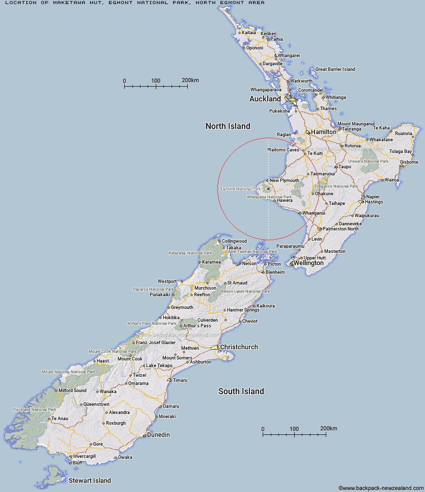
Topo Map showing location of Maketawa Hut
This information is sourced from DoC, LINZ and Openstreetmap. Some of the hut photos are mine and the rest are from DoC. I will be adding an upload feature soon so people can photos of .Maketawa Hut.
Basic info: Maketawa Hut is a good overnight tramp for families with children and those new to tramping.
Latitude: -39.2816320322
Longitude: 174.099033193
Location: Egmont National Park, North Egmont area
Area: Taranaki
Type of Hut: Serviced
Tracks: Maketawa Hut Circuit
Map: BJ29 Topo Map | Road Map
Does this hut still exist? Have any more information? Contact
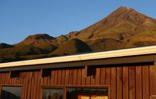
Image: DoC
Scroll down to see a topographical map and road map showing the location of Maketawa Hut
[ A ] [ B ] [ C ] [ D ] [ E ] [ F ] [ G ] [ H ] [ I ] [ J ] [ K ] [ L ] [ M ] [ N ] [ O ] [ P ] [ Q ] [ R ] [ S ] [ T ] [ U ] [ V ] [ W ] [ Y ] [ Z ]
Closest 20 Huts to Maketawa Hut
These are as the crow fliesHooker Shelter 4.11km Syme Hut 4.2km Waingongoro Hut 4.24km Holly Hut 4.81km Kaiauai Shelter 4.86km Lake Dive Hut 6.9km Pouakai Hut 7.4km Kahui Hut 7.4km Waiaua Gorge Hut 9.53km Waiweranui Trust Hut 13.1km Omaru Hut 58.41km Trains Hut 58.54km Puteore Hut 60.2km Tahupo Hut 60.46km Pouri Hut 65.01km Rerekapa Hut 66.12km Ngapurua Hut 70.32km John Coull Hut 70.33km Puketotara Hut 75.87km Tieke Kainga 77.18km Ohuraiti Hut 84.72km Downes hut 101.44km Leitchs Hut 111.3km Ten Man Hut 119.97km Mangaturuturu Hut 120.73km Whakapapaiti Hut 122.23km Lupton Hut 122.58km Blyth Hut 122.82km Mangaehuehu Hut 125.02km Whangaehu Hut 128.21km Mangatepopo Hut 129.92km Rangipo Hut 131.24km Ketetahi Shelter 135.3km Old Waihohonu Hut 135.75km Hauhungaroa Hut 136.13km Waihohonu Hut 136.36km Oturere Hut 137.67km Hamilton Tomo Group Hut 143.01km Zekes Hut 144.47km Waihaha Hut 145.26km