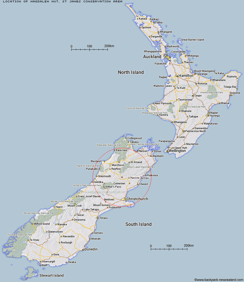
Topo Map showing location of Magdalen Hut
This information is sourced from DoC, LINZ and Openstreetmap. Some of the hut photos are mine and the rest are from DoC. I will be adding an upload feature soon so people can photos of .Magdalen Hut.
Basic info: standard five-bunk hut in the North Canterbury and Arthur's Pass area.
Latitude: -42.4972559211
Longitude: 172.474872913
Location: St James Conservation Area
Area: Canterbury
Type of Hut: Standard
Map: BU23 Topo Map | Road Map
Does this hut still exist? Have any more information? Contact
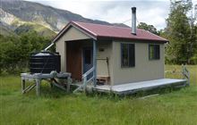
Image: DoC
Scroll down to see a topographical map and road map showing the location of Magdalen Hut
[ A ] [ B ] [ C ] [ D ] [ E ] [ F ] [ G ] [ H ] [ I ] [ J ] [ K ] [ L ] [ M ] [ N ] [ O ] [ P ] [ Q ] [ R ] [ S ] [ T ] [ U ] [ V ] [ W ] [ Y ] [ Z ]
Closest 20 Huts to Magdalen Hut
These are as the crow fliesBoyle Flat Hut 3.72km Carlyle Hut 6.14km Rokeby Hut 7.13km Steyning Hut 7.49km Tin Jug Hut 8.87km Tutu Hut 12.29km Jervois Hut 12.43km Bus Shelter 12.64km Lucretia Hut 12.96km Nina Hut 13km Stony Stream Bivouac 13.15km Devils Den Bivouac 14.84km Scotties Hut 15.48km Brass Monkey Bivouac 15.64km Old Bridge Hut 16.08km Pool Hut 16.14km Anne Cullers Hut 16.14km Doubtful Hut 16.15km Anne Hut 16.84km Upper Nina Bivouac 16.91km Lake Christabel Hut 19.21km Cannibal Gorge Hut 19.32km Hope Halfway Hut 19.59km Doubtless Hut 20.58km Valley Camp Hut 20.98km Lake Man Bivouac 21.27km Ada Pass Hut 21.48km Glenrae Bivouac 22.12km Pell Stream Hut 22.22km Saint Jacob's Hut 22.92km Museum Hut 23.26km Top Robinson Hut 24.33km Christopher Hut 24.37km Christopher Cullers Hut 24.76km Stanley Vale Hut 25.25km Bush Hut 25.58km Evangeline Bivouac 26.11km Manson-Nicholls Memorial Hut 26.25km Top Hope Hut 26.6km Jollie Brook Hut 27.32km