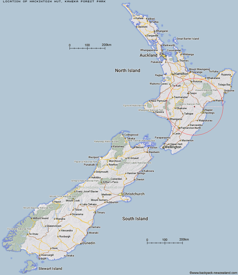
Topo Map showing location of Mackintosh Hut
This information is sourced from DoC, LINZ and Openstreetmap. Some of the hut photos are mine and the rest are from DoC. I will be adding an upload feature soon so people can photos of .Mackintosh Hut.
Basic info: Mackintosh Hut is located in the mid-southern area of the Kaweka Forest Park.
Latitude: -39.329143439
Longitude: 176.399346456
Location: Kaweka Forest Park
Area: Hawke's Bay
Type of Hut: Standard
Tracks: Kuripapango tramping tracks|Kaweka Road tramping tracks
Map: BJ37 Topo Map | Road Map
Does this hut still exist? Have any more information? Contact
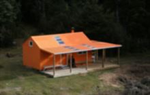
Image: DoC
Scroll down to see a topographical map and road map showing the location of Mackintosh Hut
[ A ] [ B ] [ C ] [ D ] [ E ] [ F ] [ G ] [ H ] [ I ] [ J ] [ K ] [ L ] [ M ] [ N ] [ O ] [ P ] [ Q ] [ R ] [ S ] [ T ] [ U ] [ V ] [ W ] [ Y ] [ Z ]
Closest 20 Huts to Mackintosh Hut
These are as the crow fliesStudholme Saddle Bivouac 4.04km Studholme Saddle Hut 4.34km Black Birch Bivouac 4.52km Makahu Saddle Hut 4.75km Dominie Hut 5.43km Kiwi Saddle Hut 6.75km Back Ridge Hut 6.89km Back Ridge Bivouac 7.34km Kaweka Flats Bivouac 7.6km Iron Whare 8.54km Lowry Shelter 8.93km Cameron Hut 9.91km Manson Bivouac 10.17km Kiwi Mouth Hut 10.32km Ballard Hut 10.45km Rocks Ahead Hut 10.65km Rocks Ahead Bivouac 10.75km Venison Tops Hut (Tira Lodge) 11.3km Middle Hill Hut 11.56km Old Manson Hut 12.27km Manson Hut 12.54km Omarukokere Bivouac 12.76km Mangaturutu Hut 13.61km Rock Camp Bivouac 14.26km Makino Hut 15.53km Otutu Hut 15.59km Ngaawapurua Hut 16.7km Otutu Island Hut 17.27km Comet Hut 18.13km Te Puke (Te Pukeohikarua) Hut 18.42km Harkness Hut 20.28km Shutes Hut 22.29km Mangatainoka Hut 22.44km Lower Ripia Hut 22.89km Te Matai Hut 23.46km Tussock Hut 24.12km Golden Hills Hut 24.17km Upper Ripia Hut 24.49km Tevers Hut 24.63km Ernie's Creek Hut 25.24km