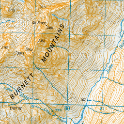
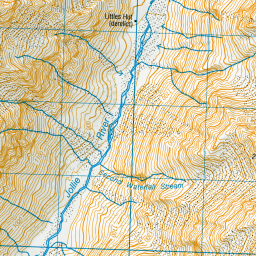
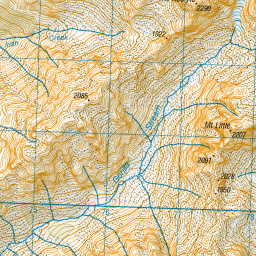
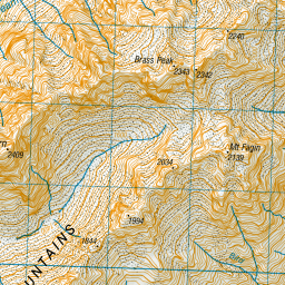
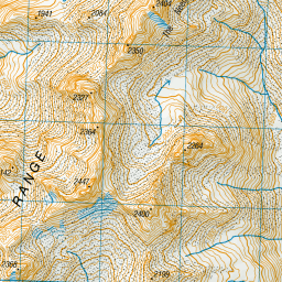
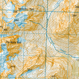
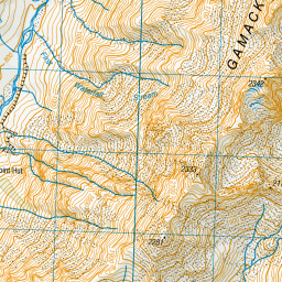
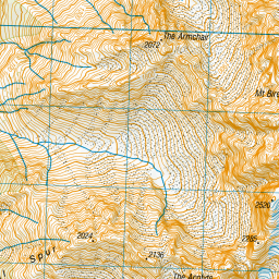
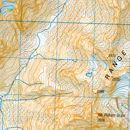
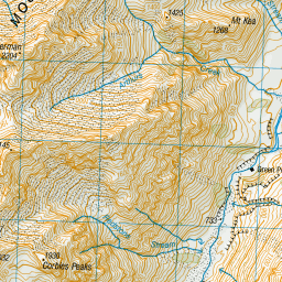
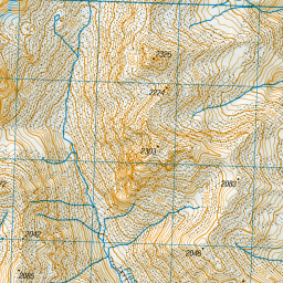
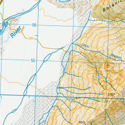
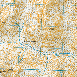
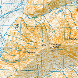
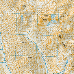
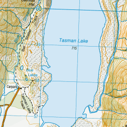
Topo Map showing location of Littles Hut
This information is sourced from DoC, LINZ and Openstreetmap. Some of the hut photos are mine and the rest are from DoC. I will be adding an upload feature soon so people can photos of .Littles Hut.
Latitude: -43.7419832666
Longitude: 170.267598869
Location:
Type of Hut:
Map: Topo Map | Road Map
Does this hut still exist? Have any more information? Contact
Latitude: -43.7419832666
Longitude: 170.267598869
Location:
Type of Hut:
Map: Topo Map | Road Map
Does this hut still exist? Have any more information? Contact
Scroll down to see a topographical map and road map showing the location of Littles Hut


Leaflet | Sourced from LINZ. CC BY 4.0


Leaflet | Map data © OpenStreetMap contributors
[ A ] [ B ] [ C ] [ D ] [ E ] [ F ] [ G ] [ H ] [ I ] [ J ] [ K ] [ L ] [ M ] [ N ] [ O ] [ P ] [ Q ] [ R ] [ S ] [ T ] [ U ] [ V ] [ W ] [ Y ] [ Z ]
Closest 20 Huts to Littles Hut
These are as the crow fliesLittles Hut 0km Green Point Hut 5.81km Tin Hut 10.48km Waterfall Hut 11.34km Ryders Hut 11.75km Memorial Hut 11.79km Birdcage Hut 11.86km Liebig Hut 13.05km Jollie Hut 13.52km Caroline Hut 14.14km Ball Hut 14.42km Stocking Stream Shelter 14.52km Onslow Hut (Steffan Memorial Hut) 15.07km Middle Gorge Hut 15.83km Mueller Hut 16.43km Sefton Bivvy 16.55km Copland Shelter 16.67km Haast Hut 18.6km Plateau Hut 18.85km Angus Hut 19.28km Ribbonwood Hut 19.74km Empress Hut 20.15km Barron Saddle Hut 21.54km Douglas Rock Hut 22.32km Maryburn Hut 22.35km Reardon Hut 22.59km Rankin Hut 22.83km Harpers Rock Bivouac 23.55km Pioneer Hut 24.38km Waterfall Hut 24.56km Kelman Hut 25.88km Tasman Saddle Hut 26.07km Centennial Hut 26.14km Telegraph Hut 26.61km Murchison Hut 26.86km Whale Stream Hut 26.87km Horace Walker Hut 28.38km Welcome Flat Campsite 28.63km Welcome Flat Hut 28.66km Chancellor Hut 28.77km