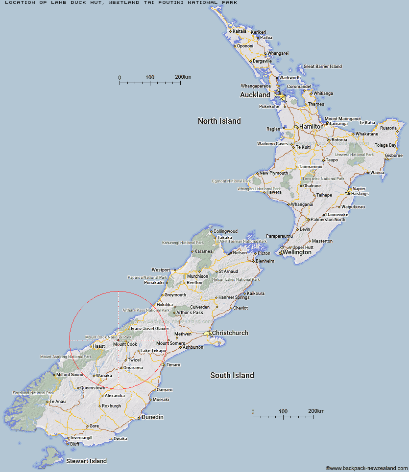
Topo Map showing location of Lame Duck Hut
This information is sourced from DoC, LINZ and Openstreetmap. Some of the hut photos are mine and the rest are from DoC. I will be adding an upload feature soon so people can photos of .Lame Duck Hut.
Basic info: standard 4-bunk hut in the Glaciers area.
Latitude: -43.7068137343
Longitude: 169.86697467
Location: Westland Tai Poutini National Park
Area: West Coast
Type of Hut: Standard
Tracks: Karangarua and Douglas valleys routes
Map: BX14 Topo Map | Road Map
Does this hut still exist? Have any more information? Contact
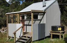
Image: DoC
Scroll down to see a topographical map and road map showing the location of Lame Duck Hut
[ A ] [ B ] [ C ] [ D ] [ E ] [ F ] [ G ] [ H ] [ I ] [ J ] [ K ] [ L ] [ M ] [ N ] [ O ] [ P ] [ Q ] [ R ] [ S ] [ T ] [ U ] [ V ] [ W ] [ Y ] [ Z ]
Closest 20 Huts to Lame Duck Hut
These are as the crow fliesChristmas Flat Hut 3.57km Horace Walker Hut 4.87km Cassel Flat Hut 6.27km Harpers Rock Bivouac 8.99km Welcome Flat Hut 10.63km Welcome Flat Campsite 10.63km Architect Creek Hut 10.75km Barron Saddle Hut 12.2km Douglas Rock Hut 13.59km Richardson Rock Bivouac 13.99km Reardon Hut 15.07km Mueller Hut 16.01km Erceg Hut 16.09km Sefton Bivvy 16.92km Waterfall Hut 17.16km Stocking Stream Shelter 18.53km Copland Shelter 19.49km Kennedy Hut 20.77km Dodger Hut 21.06km Empress Hut 23.99km Cullers Hut 24.06km Elcho Hut 25.14km Caroline Hut 25.69km Grough Hut 26km Ball Hut 27.6km Dasler Bivouac 27.79km Creswicke Flat Hut 27.97km Plateau Hut 28.95km Chancellor Hut 29.25km Tunnel Creek Hut 29.26km Haast Hut 29.9km Station Hut 30.09km Jollie Hut 31.19km Green Point Hut 31.34km Brodrick Hut 31.81km Whale Stream Hut 31.94km Pioneer Hut 32.06km Littles Hut 32.43km Red Hut 32.57km Le Crens Hut 34.51km