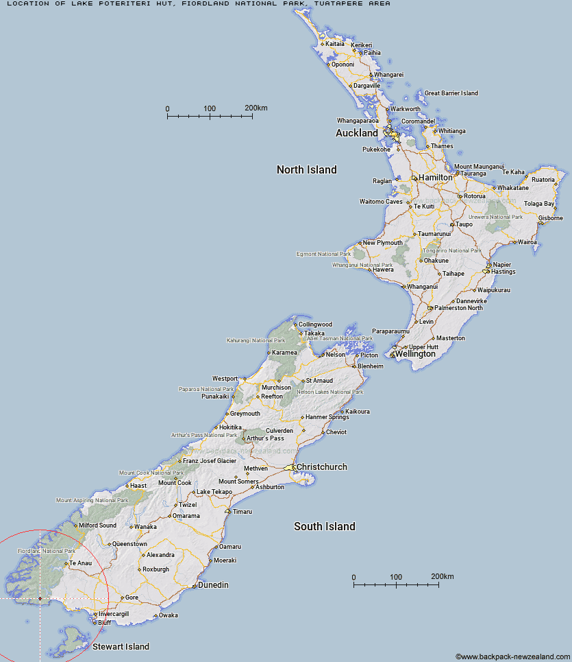
Topo Map showing location of Lake Poteriteri Hut
This information is sourced from DoC, LINZ and Openstreetmap. Some of the hut photos are mine and the rest are from DoC. I will be adding an upload feature soon so people can photos of .Lake Poteriteri Hut.
Basic info: standard six-bunk hut in southern Fiordland.
Latitude: -46.1108584126
Longitude: 167.153292914
Location: Fiordland National Park, Tuatapere area
Area: Fiordland
Type of Hut: Standard
Map: CF06 Topo Map | Road Map
Does this hut still exist? Have any more information? Contact
Basic info: standard six-bunk hut in southern Fiordland.
Latitude: -46.1108584126
Longitude: 167.153292914
Location: Fiordland National Park, Tuatapere area
Area: Fiordland
Type of Hut: Standard
Map: CF06 Topo Map | Road Map
Does this hut still exist? Have any more information? Contact
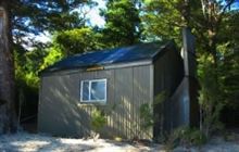
Image: DoC
Scroll down to see a topographical map and road map showing the location of Lake Poteriteri Hut
[ A ] [ B ] [ C ] [ D ] [ E ] [ F ] [ G ] [ H ] [ I ] [ J ] [ K ] [ L ] [ M ] [ N ] [ O ] [ P ] [ Q ] [ R ] [ S ] [ T ] [ U ] [ V ] [ W ] [ Y ] [ Z ]
Closest 20 Huts to Lake Poteriteri Hut
These are as the crow fliesLake Poteriteri Hut 0km Slaughterburn Hut 11.26km Teal Bay Hut 11.97km Okaka Lodge 13.24km Waitutu Hut 15.66km Wairaurahiri Hut 16.65km Percy Burn Hut 18.64km Westies Hut 19.76km Port Craig Lodge 20.25km Port Craig School Hut 20.28km Caroline Hut 21.36km Eel Creek Hut 30.09km Hauroko Burn Hut 31.16km Monowai Hut 34.28km Rodger Inlet Huts 35.99km Te Oneroa Hut 37.08km Clark Hut - A Frame 38km Historic Clark Hut 38.47km Halfway Hut 39.04km Green Lake Hut 40.9km Borland Bivouac 44.56km Lake Roe Hut 45.3km Loch Maree Hut 47.85km Supper Cove Hut 48.22km North Borland Hut 53.82km Kintail Hut 55.25km Martin's Hut 56.99km Turnbull's (Big Dam) Hut 57.43km Upper Spey Hut 59km Percy Shelter 59.49km Barcoo Hut 61.24km Rock Hut 64.34km Hope Arm Hut 65.26km West Arm Hut 65.64km Back Valley Hut 65.73km Telford Hut 66.78km Redcliff Hut 67.8km Upper Wairaki Hut 70.63km Lower Wairaki Hut 71.16km Whare Creek Hut 71.67km