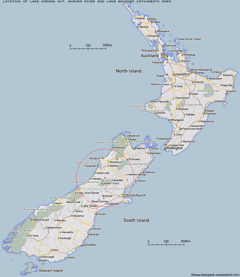
Topo Map showing location of Lake Morgan Hut
This information is sourced from DoC, LINZ and Openstreetmap. Some of the hut photos are mine and the rest are from DoC. I will be adding an upload feature soon so people can photos of .Lake Morgan Hut.
Basic info: basic six-bunk hut in the Greymouth area.
Latitude: -42.6633857688
Longitude: 171.709302137
Location: Ahaura River and Lake Brunner catchments area
Area: West Coast
Type of Hut: Basic/bivvies
Tracks: Ahaura River & Lake Brunner catchments routes
Map: BU21 Topo Map | Road Map
Does this hut still exist? Have any more information? Contact
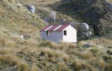
Image: DoC
Scroll down to see a topographical map and road map showing the location of Lake Morgan Hut
[ A ] [ B ] [ C ] [ D ] [ E ] [ F ] [ G ] [ H ] [ I ] [ J ] [ K ] [ L ] [ M ] [ N ] [ O ] [ P ] [ Q ] [ R ] [ S ] [ T ] [ U ] [ V ] [ W ] [ Y ] [ Z ]
Closest 20 Huts to Lake Morgan Hut
These are as the crow fliesCone Creek Hut 2.88km Top Crooked Hut 4.79km Elizabeth Hut 6.68km Jacko Flat Hut 8.11km Kiwi Hut 10.77km Top Trent / Lagoon Hut 10.89km Camp Creek Hut 12.99km Waikiti Hut 13.02km Locke Stream Hut 13.04km Townsend Hut 13.53km Mid Trent Hut 15.41km Pfeifer Bivouac 15.96km Koropuku Hut 16.65km Minchin Bivouac 16.77km Harper Pass Bivouac 16.77km Poulter Bivouac 17.62km Carroll Hut 19.09km Camerons Hut 20.54km Otehake Hut 21.59km Worsley Bivouac 21.77km Tutaekuri Hut 22.16km Poulter Hut 22.26km Dillons Homestead Hut 22.67km Dillon Hut 22.72km Hurunui No 3 Hut 23.16km Trust/Poulter Hut 23.9km Upper South Branch Hurunui Hut 25.3km Mackenzie Hut 25.34km Jim's Flat Hut 25.5km Upper Deception Hut 25.68km Hunts Creek Hut 26.01km Ranger Bivouac 26.28km East Hawdon Bivouac 26.87km Goat Pass Hut 27.37km Hawdon Hut 27.61km Rocky Creek Bivouac 28.07km Scottys Bivouac 29.06km Mackenzie Bivouac 29.19km Mingha Bivouac 29.56km Dunns Creek Hut 29.81km