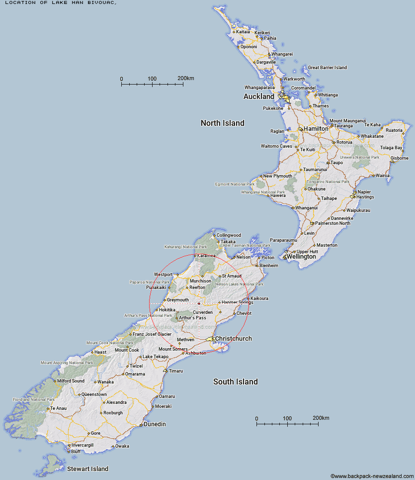
Topo Map showing location of Lake Man Bivouac
This information is sourced from DoC, LINZ and Openstreetmap. Some of the hut photos are mine and the rest are from DoC. I will be adding an upload feature soon so people can photos of .Lake Man Bivouac.
Latitude: -42.5490727303
Longitude: 172.22501832
Location:
Type of Hut:
Map: Topo Map | Road Map
Does this hut still exist? Have any more information? Contact
Latitude: -42.5490727303
Longitude: 172.22501832
Location:
Type of Hut:
Map: Topo Map | Road Map
Does this hut still exist? Have any more information? Contact
Scroll down to see a topographical map and road map showing the location of Lake Man Bivouac
[ A ] [ B ] [ C ] [ D ] [ E ] [ F ] [ G ] [ H ] [ I ] [ J ] [ K ] [ L ] [ M ] [ N ] [ O ] [ P ] [ Q ] [ R ] [ S ] [ T ] [ U ] [ V ] [ W ] [ Y ] [ Z ]
Closest 20 Huts to Lake Man Bivouac
These are as the crow fliesDoubtless Hut 3.01km Doubtful Hut 5.17km Top Hope Hut 6.08km Saint Jacob's Hut 6.28km Top Robinson Hut 8.73km Devils Den Bivouac 8.87km Museum Hut 9.42km Hope Halfway Hut 9.52km Upper Nina Bivouac 9.64km Slaty Creek Hut 11.5km Nina Hut 12.21km Lake Christabel Hut 12.69km Mid Robinson Hut 12.79km Bus Shelter 13.11km Three Mile Stream Hut 13.28km Evangeline Bivouac 15.47km Brass Monkey Bivouac 16.23km Lucretia Hut 16.93km Mackenzie Bivouac 17.09km Lake Sumner Hut 18.74km Gabriel Hut 19.86km Hurunui Hut 20.18km Mackenzie Hut 20.19km Jollie Brook Hut 20.98km Magdalen Hut 21.27km Boyle Flat Hut 21.43km Lake Mason Hut 21.66km Tutaekuri Hut 21.96km Carlyle Hut 22.18km Rokeby Hut 23.39km Glenrae Bivouac 24.07km South Branch Research Hut 24.88km Stony Stream Hut 25.17km Cold Stream Hut 25.19km Hurunui No 3 Hut 25.7km Pell Stream Hut 26.59km Manson-Nicholls Memorial Hut 27.66km Camerons Hut 28.67km Steyning Hut 28.7km Bush Camp Hut 29.39km