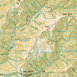
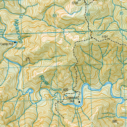
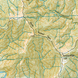
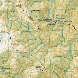
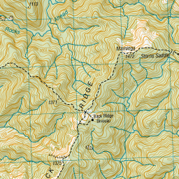
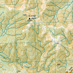
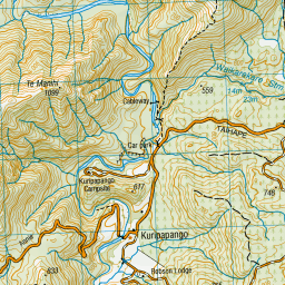
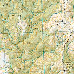
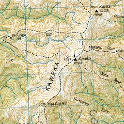
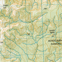
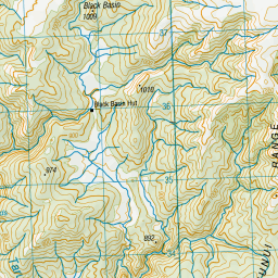
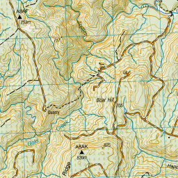
Topo Map showing location of Kiwi Saddle Hut
This information is sourced from DoC, LINZ and Openstreetmap. Some of the hut photos are mine and the rest are from DoC. I will be adding an upload feature soon so people can photos of .Kiwi Saddle Hut.
Basic info: Kiwi Saddle Hut is located in the southern Kaweka Forest Park area at the foot of an open high altitude saddle.
Latitude: -39.3329628071
Longitude: 176.320998469
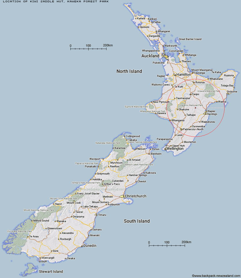
Location: Kaweka Forest Park
Area: Hawke's Bay
Type of Hut: Standard
Tracks: Kuripapango tramping tracks
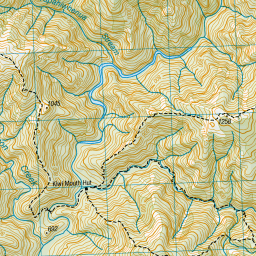
Map: BJ37 Topo Map | Road Map
Does this hut still exist? Have any more information? Contact
Basic info: Kiwi Saddle Hut is located in the southern Kaweka Forest Park area at the foot of an open high altitude saddle.
Latitude: -39.3329628071
Longitude: 176.320998469
Location: Kaweka Forest Park
Area: Hawke's Bay
Type of Hut: Standard
Tracks: Kuripapango tramping tracks
Map: BJ37 Topo Map | Road Map
Does this hut still exist? Have any more information? Contact
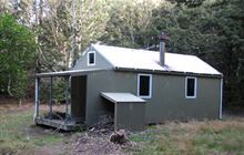
Image: DoC
Scroll down to see a topographical map and road map showing the location of Kiwi Saddle Hut
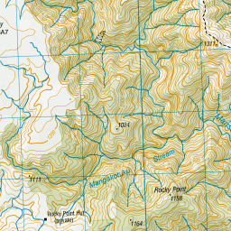
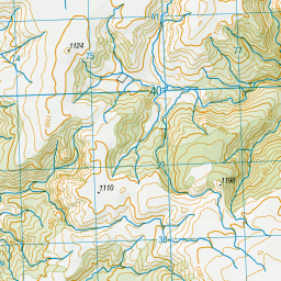
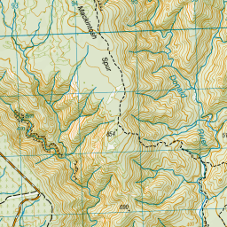
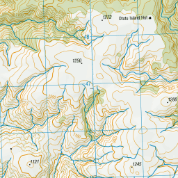
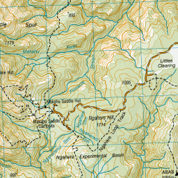

Leaflet | Sourced from LINZ. CC BY 4.0


Leaflet | Map data © OpenStreetMap contributors
[ A ] [ B ] [ C ] [ D ] [ E ] [ F ] [ G ] [ H ] [ I ] [ J ] [ K ] [ L ] [ M ] [ N ] [ O ] [ P ] [ Q ] [ R ] [ S ] [ T ] [ U ] [ V ] [ W ] [ Y ] [ Z ]
Closest 20 Huts to Kiwi Saddle Hut
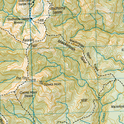
These are as the crow fliesKiwi Mouth Hut 3.66km Cameron Hut 4.05km Studholme Saddle Bivouac 4.77km Manson Bivouac 4.86km Back Ridge Bivouac 4.94km Studholme Saddle Hut 5.14km Old Manson Hut 6.4km Manson Hut 6.66km Rocks Ahead Hut 6.72km Rocks Ahead Bivouac 6.74km Mackintosh Hut 6.75km Back Ridge Hut 6.95km Rock Camp Bivouac 7.51km Dominie Hut 8.57km Makahu Saddle Hut 9.05km Venison Tops Hut (Tira Lodge) 9.54km Omarukokere Bivouac 9.56km Otutu Hut 10.05km Black Birch Bivouac 10.67km Ballard Hut 11.36km Kaweka Flats Bivouac 11.39km Lowry Shelter 11.57km Otutu Island Hut 11.58km Ngaawapurua Hut 12.61km Mangaturutu Hut 12.67km Iron Whare 12.72km Middle Hill Hut 14.85km Comet Hut 15.3km Te Puke (Te Pukeohikarua) Hut 15.97km Harkness Hut 16.84km Makino Hut 17.6km Golden Hills Hut 18.93km Shutes Hut 20.03km Tussock Hut 20.71km Mangatainoka Hut 21.05km Cedars Hut (Blowfly) 21.48km Te Apunga Hut 23.37km Dianes Hut 23.5km Taruarau Bivouac 23.62km Ruahine Hut 24.92km