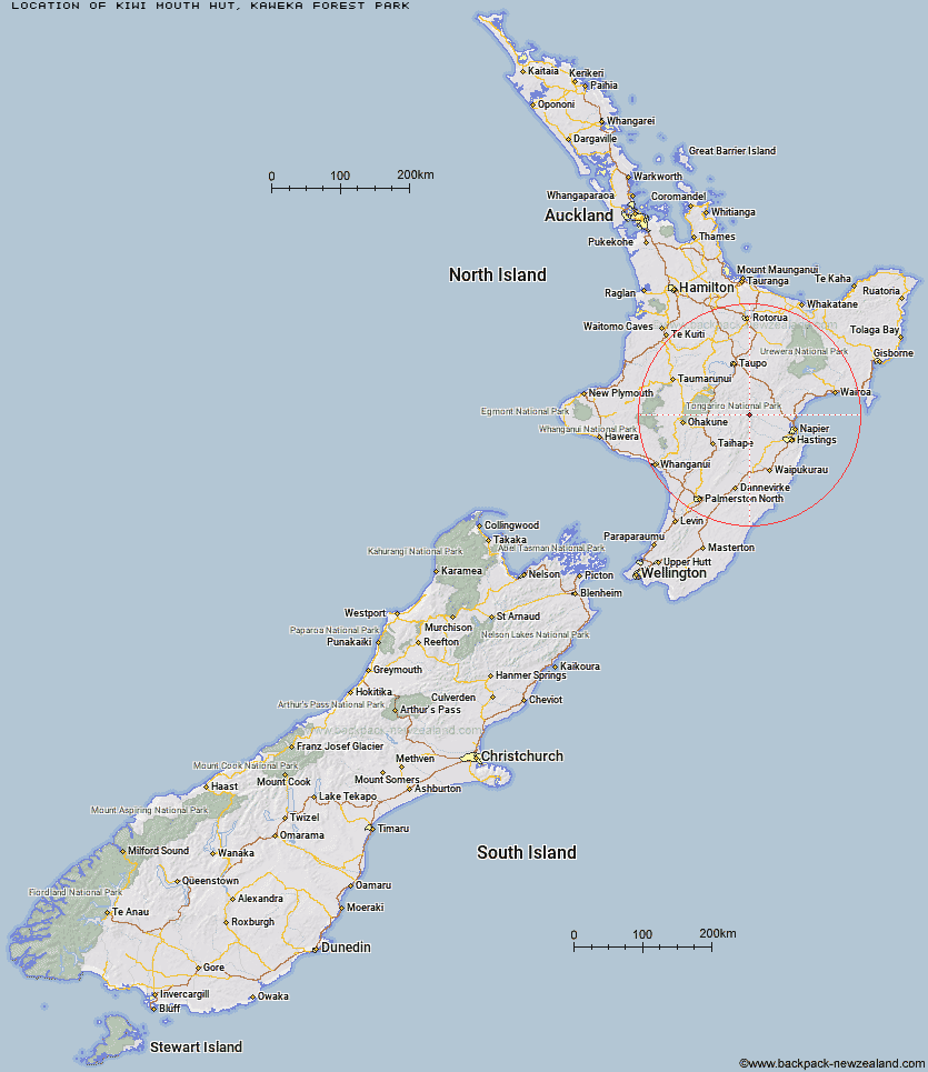
Topo Map showing location of Kiwi Mouth Hut
This information is sourced from DoC, LINZ and Openstreetmap. Some of the hut photos are mine and the rest are from DoC. I will be adding an upload feature soon so people can photos of .Kiwi Mouth Hut.
Basic info: Kiwi Mouth Hut is an ideal tramping stopover point for access into the southern area of Manson Country.
Latitude: -39.3255295848
Longitude: 176.279504147
Location: Kaweka Forest Park
Area: Hawke's Bay
Type of Hut: Standard
Tracks: Cameron carpark tramping tracks
Map: BJ37 Topo Map | Road Map
Does this hut still exist? Have any more information? Contact
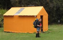
Image: DoC
Scroll down to see a topographical map and road map showing the location of Kiwi Mouth Hut
[ A ] [ B ] [ C ] [ D ] [ E ] [ F ] [ G ] [ H ] [ I ] [ J ] [ K ] [ L ] [ M ] [ N ] [ O ] [ P ] [ Q ] [ R ] [ S ] [ T ] [ U ] [ V ] [ W ] [ Y ] [ Z ]
Closest 20 Huts to Kiwi Mouth Hut
These are as the crow fliesManson Bivouac 3.25km Old Manson Hut 3.48km Kiwi Saddle Hut 3.66km Manson Hut 3.67km Cameron Hut 4.17km Rock Camp Bivouac 4.18km Rocks Ahead Bivouac 5.7km Rocks Ahead Hut 5.75km Back Ridge Bivouac 6.01km Otutu Hut 7.03km Studholme Saddle Bivouac 7.57km Studholme Saddle Hut 7.79km Otutu Island Hut 8.38km Omarukokere Bivouac 8.46km Back Ridge Hut 8.55km Venison Tops Hut (Tira Lodge) 9.44km Mackintosh Hut 10.32km Ngaawapurua Hut 10.49km Dominie Hut 11.05km Makahu Saddle Hut 11.84km Ballard Hut 12.45km Mangaturutu Hut 12.59km Kaweka Flats Bivouac 13.75km Black Birch Bivouac 13.91km Te Puke (Te Pukeohikarua) Hut 14.68km Lowry Shelter 14.76km Harkness Hut 14.88km Iron Whare 15.11km Golden Hills Hut 15.81km Comet Hut 15.91km Middle Hill Hut 16.72km Tussock Hut 18.62km Makino Hut 18.71km Te Apunga Hut 19.85km Mangatainoka Hut 20.13km Cedars Hut (Blowfly) 20.33km Shutes Hut 20.74km Taruarau Bivouac 24.03km Dianes Hut 24.11km WTFRW Hut 25.54km