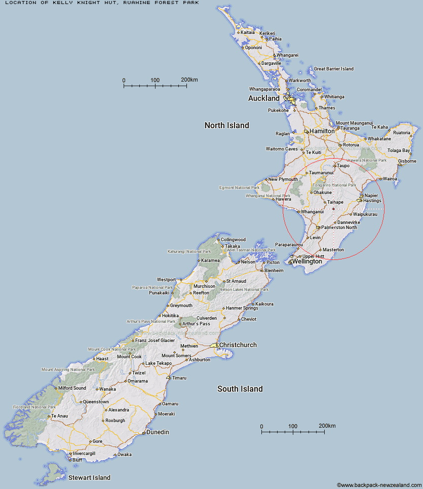
Topo Map showing location of Kelly Knight Hut
This information is sourced from DoC, LINZ and Openstreetmap. Some of the hut photos are mine and the rest are from DoC. I will be adding an upload feature soon so people can photos of .Kelly Knight Hut.
Basic info: standard eight-bunk hut in the Manawatu.
Latitude: -39.8501463213
Longitude: 176.053111966
Location: Ruahine Forest Park
Area: Manawatu/Whanganui
Type of Hut: Standard
Tracks: Kelly Knight Hut Track|Purity - Kelly Knight Hut Loop Track
Map: BL36 Topo Map | Road Map
Does this hut still exist? Have any more information? Contact
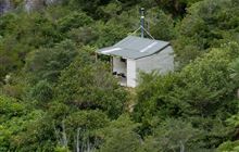
Image: DoC
Scroll down to see a topographical map and road map showing the location of Kelly Knight Hut
[ A ] [ B ] [ C ] [ D ] [ E ] [ F ] [ G ] [ H ] [ I ] [ J ] [ K ] [ L ] [ M ] [ N ] [ O ] [ P ] [ Q ] [ R ] [ S ] [ T ] [ U ] [ V ] [ W ] [ Y ] [ Z ]
Closest 20 Huts to Kelly Knight Hut
These are as the crow fliesPourangaki Hut 2.54km Purity Hut 3.33km Rangiwahia Hut 5.41km Waterfall Hut 5.71km Triangle Hut 6.33km Waikamaka Hut 8.11km McKinnon Hut 8.41km Iron Gate Hut 8.55km Tarn Bivouac 8.61km Howletts Hut 8.68km Crow Hut 9.65km Smiths Stream Hut 10.01km Hinerua Hut 10.03km Kawhatau Base 10.04km Daphne Hut 10.47km Waipawa Forks Hut 11.89km Alice Nash Memorial Heritage Lodge 12.03km Sunrise Hut 12.04km Top Maropea Hut 12.3km Wakelings Hut 12.48km Longview Hut 12.71km Top Gorge Hut 13.76km Triplex Hut 13.9km Toka Bivouac 14.88km Maropea Forks Hut 15.24km Awatere Hut 15.28km Gold Creek Hut 15.74km Sparrowhawk Bivouac 16.48km Otukota Hut 16.53km Leon Kinvig Hut 17.23km Makaretu Hut 17.85km Happy Daze Hut 18km Norris Hut 18.25km Iron Bark Hut 19.03km Barlow Hut 20.31km Ngamoko Hut 20.6km Colenso Hut 21.22km Piripiri Hut 21.24km Kylie Bivouac 22.71km Mid Pohangina Hut 22.79km