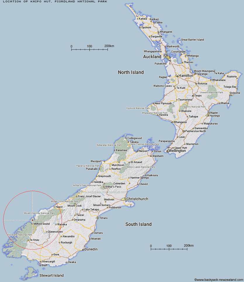
Topo Map showing location of Kaipo Hut
This information is sourced from DoC, LINZ and Openstreetmap. Some of the hut photos are mine and the rest are from DoC. I will be adding an upload feature soon so people can photos of .Kaipo Hut.
Basic info: basic six-bunk hut in northern Fiordland.
Latitude: -44.4885821291
Longitude: 167.943745787
Location: Fiordland National Park
Area: Fiordland
Type of Hut: Basic/bivvies
Map: CA08 Topo Map | Road Map
Does this hut still exist? Have any more information? Contact
Basic info: basic six-bunk hut in northern Fiordland.
Latitude: -44.4885821291
Longitude: 167.943745787
Location: Fiordland National Park
Area: Fiordland
Type of Hut: Basic/bivvies
Map: CA08 Topo Map | Road Map
Does this hut still exist? Have any more information? Contact
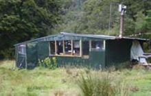
Image: DoC
Scroll down to see a topographical map and road map showing the location of Kaipo Hut
[ A ] [ B ] [ C ] [ D ] [ E ] [ F ] [ G ] [ H ] [ I ] [ J ] [ K ] [ L ] [ M ] [ N ] [ O ] [ P ] [ Q ] [ R ] [ S ] [ T ] [ U ] [ V ] [ W ] [ Y ] [ Z ]
Closest 20 Huts to Kaipo Hut
These are as the crow fliesMcKerrow Island Hut 10.04km Demon Trail Hut 10.3km Hokuri Hut 11.68km Pawnbroker Rock 11.75km Turners Bivouac 15.87km Lake Alabaster Hut 17.12km Martins Bay Hut 17.73km Hidden Falls Hut 20.21km Sunshine Hut 20.86km Olivine Hut 22km Sandfly Point Shelter 22.01km Big Bay Hut 25.11km Giant Gate Shelter 25.31km Gill's Bivvy 28.32km Phil's Bivvy 29.16km Boatshed Hut 29.9km Boatshed Shelter 29.91km Homer Hut 31.34km Routeburn Falls Hut 33.26km Routeburn Falls Lodge 33.26km Routeburn Flats Hut 34.02km Dumpling Hut 34.17km Daleys Flat Hut 34.78km Lake Mackenzie Hut 35.96km Lake Mackenzie Lodge 36.07km Andersons Cascade Shelter 36.52km Routeburn Shelter 36.85km Quintin Lodge 36.89km Mackinnon Pass Shelter 37.35km Mintaro Hut 37.95km Gorge River Hut 39.26km Esquilant Bivvy Hut 39.33km Lake Howden Hut 39.39km The Divide Shelter 39.84km Pompolona Lodge 40.42km Bus Stop Shelter 40.66km Prairie Shelter 40.99km Kay Creek Hut 42.02km Earnslaw Hut 42.58km Hirere Shelter 43.17km