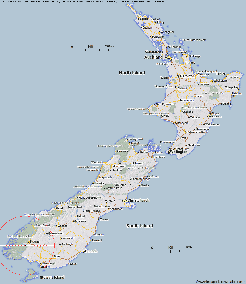
Topo Map showing location of Hope Arm Hut
This information is sourced from DoC, LINZ and Openstreetmap. Some of the hut photos are mine and the rest are from DoC. I will be adding an upload feature soon so people can photos of .Hope Arm Hut.
Basic info: standard 12-bunk hut in eastern Fiordland.
Latitude: -45.5899053558
Longitude: 167.541398919
Location: Fiordland National Park, Lake Manapouri area
Area: Fiordland
Type of Hut: Standard
Tracks: Monument Track|Stockyard Cove Track
Map: CE07 Topo Map | Road Map
Does this hut still exist? Have any more information? Contact
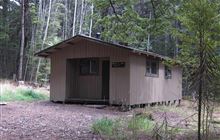
Image: DoC
Scroll down to see a topographical map and road map showing the location of Hope Arm Hut
[ A ] [ B ] [ C ] [ D ] [ E ] [ F ] [ G ] [ H ] [ I ] [ J ] [ K ] [ L ] [ M ] [ N ] [ O ] [ P ] [ Q ] [ R ] [ S ] [ T ] [ U ] [ V ] [ W ] [ Y ] [ Z ]
Closest 20 Huts to Hope Arm Hut
These are as the crow fliesBack Valley Hut 3.34km North Borland Hut 11.51km Shallow Bay Hut 12.08km Moturau Hut 13.18km Percy Shelter 16.95km Cheviot Downs Hut 19.56km Freeman Burn Hut 20.79km Borland Bivouac 21.28km Iris Burn Hut 21.37km Forest Burn Shelter 22.41km West Arm Hut 22.81km Hanging Valley Shelter 23.03km Brod Bay Shelter and Campsite 23.06km Luxmore Hut 23.55km Whare Creek Hut 23.79km Green Lake Hut 24.37km Redcliff Hut 26.55km Historic Clark Hut 27.71km Clark Hut - A Frame 27.8km Upper Princhester Hut 29.2km Spence Hut 29.21km Upper Spey Hut 29.45km Telford Hut 29.77km Rodger Inlet Huts 30.71km Monowai Hut 31km Upper Wairaki Hut 31.48km Aparima Forks Hut 31.54km Lower Princhester Hut 31.91km Kintail Hut 33.22km Lake Roe Hut 33.4km Eel Creek Hut 35.37km Halfway Hut 36.26km Becketts Hut 36.62km Lower Wairaki Hut 37.5km Aparima Huts 37.9km Rock Hut 38.42km Loch Maree Hut 38.47km Barcoo Hut 38.67km Hauroko Burn Hut 40.76km Caroline Hut 43.91km