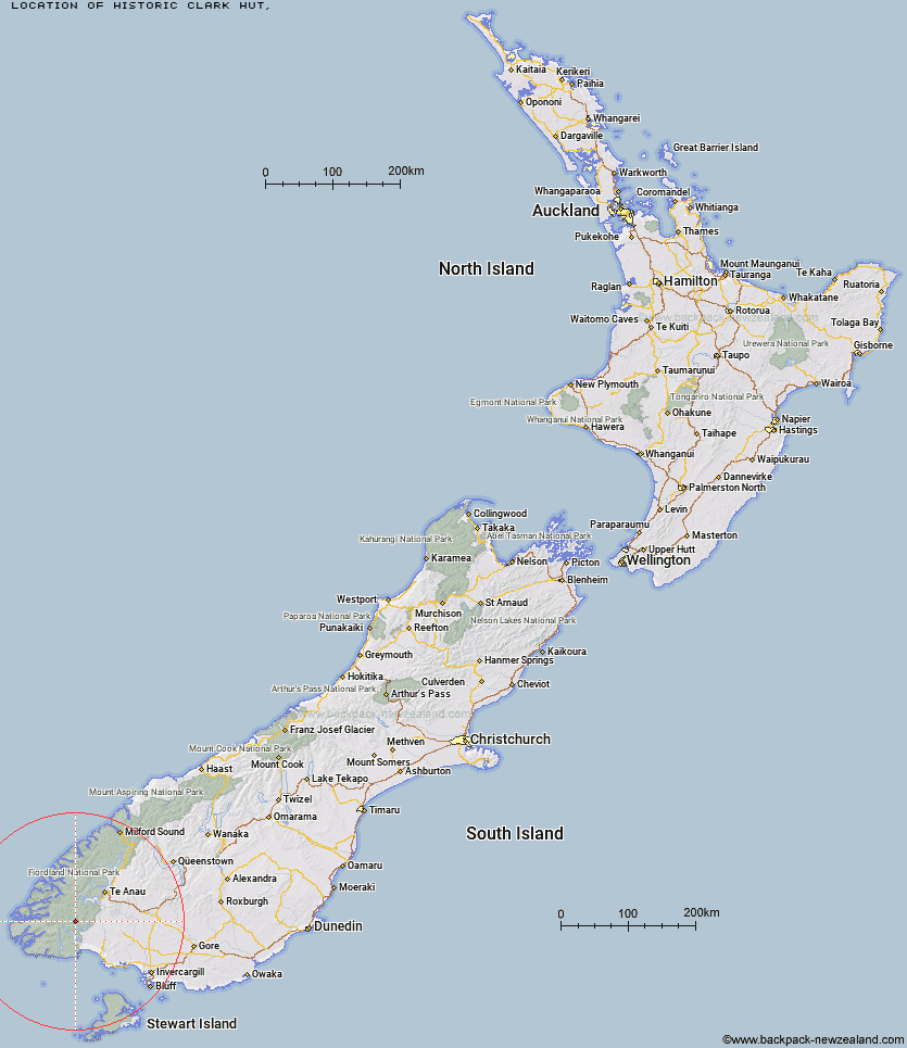
Topo Map showing location of Historic Clark Hut
This information is sourced from DoC, LINZ and Openstreetmap. Some of the hut photos are mine and the rest are from DoC. I will be adding an upload feature soon so people can photos of .Historic Clark Hut.
Latitude: -45.7845414137
Longitude: 167.318597273
Location:
Type of Hut:
Map: Topo Map | Road Map
Does this hut still exist? Have any more information? Contact
Latitude: -45.7845414137
Longitude: 167.318597273
Location:
Type of Hut:
Map: Topo Map | Road Map
Does this hut still exist? Have any more information? Contact
Scroll down to see a topographical map and road map showing the location of Historic Clark Hut
[ A ] [ B ] [ C ] [ D ] [ E ] [ F ] [ G ] [ H ] [ I ] [ J ] [ K ] [ L ] [ M ] [ N ] [ O ] [ P ] [ Q ] [ R ] [ S ] [ T ] [ U ] [ V ] [ W ] [ Y ] [ Z ]
Closest 20 Huts to Historic Clark Hut
These are as the crow fliesHistoric Clark Hut 0km Clark Hut - A Frame 1.32km Monowai Hut 6.03km Green Lake Hut 6.32km Borland Bivouac 6.43km Eel Creek Hut 11.36km Rodger Inlet Huts 12.61km Halfway Hut 13.89km Hauroko Burn Hut 14.36km Lake Roe Hut 16.29km North Borland Hut 17.01km Caroline Hut 17.65km Percy Shelter 21.73km Loch Maree Hut 22.54km Kintail Hut 24.59km Upper Spey Hut 25.72km Hope Arm Hut 27.71km Back Valley Hut 28.91km West Arm Hut 29.12km Supper Cove Hut 30.43km Teal Bay Hut 31.41km Lake Poteriteri Hut 38.47km Freeman Burn Hut 38.57km Shallow Bay Hut 39.63km Cheviot Downs Hut 40.03km Redcliff Hut 40.08km Moturau Hut 40.61km Telford Hut 41.06km Whare Creek Hut 41.48km Okaka Lodge 41.65km Barcoo Hut 42.58km Spence Hut 44.35km Rock Hut 44.44km Upper Wairaki Hut 44.62km Iris Burn Hut 45.37km Hanging Valley Shelter 47.77km Forest Burn Shelter 48.15km Lower Wairaki Hut 48.24km Port Craig Lodge 48.74km Port Craig School Hut 48.82km