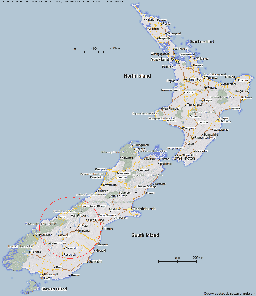
Topo Map showing location of Hideaway Hut
This information is sourced from DoC, LINZ and Openstreetmap. Some of the hut photos are mine and the rest are from DoC. I will be adding an upload feature soon so people can photos of .Hideaway Hut.
Basic info: basic hut in the Mackenzie Country and Waitaki area.
Latitude: -44.3458433992
Longitude: 169.681056775
Location: Ahuriri Conservation Park
Area: Canterbury
Type of Hut: Basic/bivvies
Tracks: Hideaway Hut Route
Map: BZ14 Topo Map | Road Map
Does this hut still exist? Have any more information? Contact
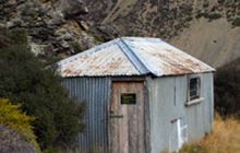
Image: DoC
Scroll down to see a topographical map and road map showing the location of Hideaway Hut
[ A ] [ B ] [ C ] [ D ] [ E ] [ F ] [ G ] [ H ] [ I ] [ J ] [ K ] [ L ] [ M ] [ N ] [ O ] [ P ] [ Q ] [ R ] [ S ] [ T ] [ U ] [ V ] [ W ] [ Y ] [ Z ]
Closest 20 Huts to Hideaway Hut
These are as the crow fliesSnowy Gorge Hut 7.12km Ahuriri Base Hut 10.48km Ben Avon Hut 11.78km Top Dingle Hut 12.3km Cotters Hut 13.13km Maitland Hut 15.19km Shamrock Hut 16.11km Bush Hut 18.76km Green Bush Hut 19.34km Burnt Bush Hut 19.74km Top Timaru Hut 19.89km Little Boundary Hut 20.61km Boundary Hut 20.68km Mae West Bivouac 20.82km High Burn Hut 20.98km Hagens Hut 21.43km Scrubby Hut 22.91km Bull Flat Hut 23.79km South Temple Hut 24.3km Top Hut 24.91km Ferguson Hut 27.24km Moonlight & Roses Hut 27.72km Big Hopwood Burn Hut 28.79km Stodys Hut 29.42km Makarora Hut 30.77km Junction Hut 32.08km Cameron Hut 33.34km Forbes Hut 33.38km South Huxley Bivouac 33.63km Sawyer Burn Hut 34.58km Brewster Hut 35.81km Pakituhi Hut 36.79km Monument Hut 37.28km Top Hut 37.9km Main Huxley Forks Hut 37.96km Wills Hut 38.38km Polson's Hut 39.09km Baikie Hut 40.43km Red Hut 40.48km Craigie Burn Hut 41.3km