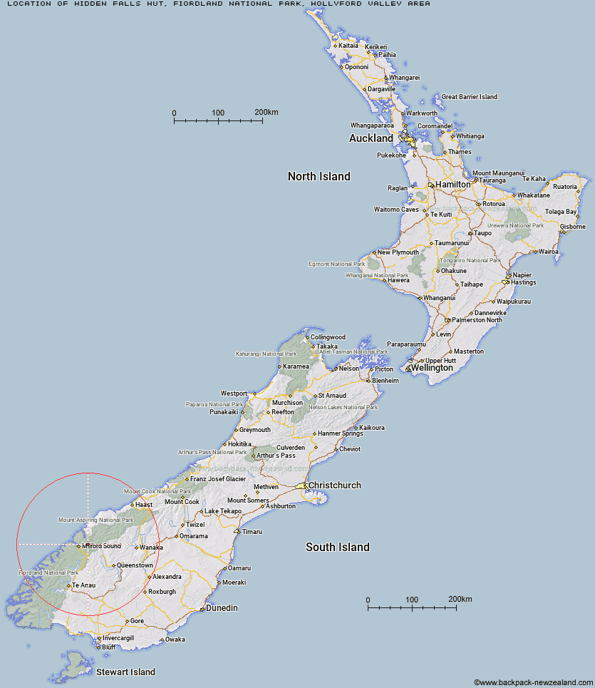
Topo Map showing location of Hidden Falls Hut
This information is sourced from DoC, LINZ and Openstreetmap. Some of the hut photos are mine and the rest are from DoC. I will be adding an upload feature soon so people can photos of .Hidden Falls Hut.
Basic info: serviced 12-bunk hut in northern Fiordland.
Latitude: -44.6235792993
Longitude: 168.114513177
Location: Fiordland National Park, Hollyford Valley area
Area: Fiordland
Type of Hut: Serviced
Tracks: Hollyford Track
Map: CA09 Topo Map | Road Map
Does this hut still exist? Have any more information? Contact
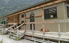
Image: DoC
Scroll down to see a topographical map and road map showing the location of Hidden Falls Hut
[ A ] [ B ] [ C ] [ D ] [ E ] [ F ] [ G ] [ H ] [ I ] [ J ] [ K ] [ L ] [ M ] [ N ] [ O ] [ P ] [ Q ] [ R ] [ S ] [ T ] [ U ] [ V ] [ W ] [ Y ] [ Z ]
Closest 20 Huts to Hidden Falls Hut
These are as the crow fliesHidden Falls Hut 0km Sunshine Hut 0.69km Turners Bivouac 7.42km Lake Alabaster Hut 8.95km Pawnbroker Rock 10.85km McKerrow Island Hut 12.42km Routeburn Falls Hut 13.21km Routeburn Falls Lodge 13.22km Routeburn Flats Hut 13.87km Gill's Bivvy 13.88km Phil's Bivvy 14.45km Demon Trail Hut 14.75km Lake Mackenzie Hut 16.67km Routeburn Shelter 16.74km Lake Mackenzie Lodge 16.8km Sandfly Point Shelter 18.15km Homer Hut 18.27km Kaipo Hut 20.21km Lake Howden Hut 21.41km Olivine Hut 21.49km Kay Creek Hut 22.13km Daleys Flat Hut 22.22km The Divide Shelter 22.38km Giant Gate Shelter 22.78km Hokuri Hut 22.98km Esquilant Bivvy Hut 23.17km Upper Caples Hut 25.94km Earnslaw Hut 26.36km McKellar Lodge 27.47km McKellar Hut 27.7km Boatshed Hut 27.78km Boatshed Shelter 27.81km Twenty Five Mile Hut 28.23km Dumpling Hut 31.98km Shelter Rock Hut 32.05km Mid Caples Hut 32.36km Andersons Cascade Shelter 32.92km Martins Bay Hut 33.33km Mackinnon Pass Shelter 33.37km Mintaro Hut 33.48km