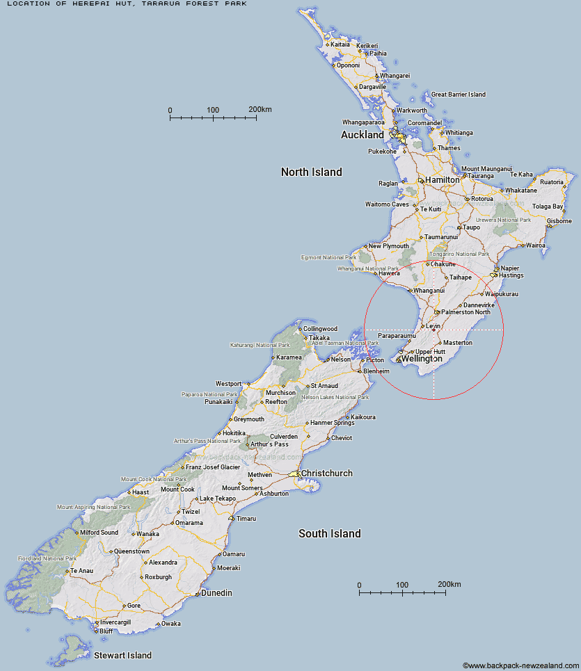
Topo Map showing location of Herepai Hut
This information is sourced from DoC, LINZ and Openstreetmap. Some of the hut photos are mine and the rest are from DoC. I will be adding an upload feature soon so people can photos of .Herepai Hut.
Basic info: standard 10-bunk hut in the Wairarapa region.
Latitude: -40.6921519722
Longitude: 175.523179906
Location: Tararua Forest Park
Area: Wairarapa
Type of Hut: Standard
Map: BN34 Topo Map | Road Map
Does this hut still exist? Have any more information? Contact
Basic info: standard 10-bunk hut in the Wairarapa region.
Latitude: -40.6921519722
Longitude: 175.523179906
Location: Tararua Forest Park
Area: Wairarapa
Type of Hut: Standard
Map: BN34 Topo Map | Road Map
Does this hut still exist? Have any more information? Contact
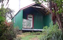
Image: DoC
Scroll down to see a topographical map and road map showing the location of Herepai Hut
[ A ] [ B ] [ C ] [ D ] [ E ] [ F ] [ G ] [ H ] [ I ] [ J ] [ K ] [ L ] [ M ] [ N ] [ O ] [ P ] [ Q ] [ R ] [ S ] [ T ] [ U ] [ V ] [ W ] [ Y ] [ Z ]
Closest 20 Huts to Herepai Hut
These are as the crow fliesRoaring Stag Hut 4.28km Cattle Ridge Hut 4.52km Dundas Hut 5.53km Mangahao Flats Hut 7.35km Burn Hut 8km Arete Hut 9.59km Cow Creek Hut 9.79km Arete Forks Hut 9.92km North Ohau Hut 10.18km Blue Range Hut 11.26km South Ohau Hut 11.6km Te Matawai Hut 11.64km Tarn Ridge Hut 13.2km Dracophyllum Hut 14.19km Waiopehu Hut 14.52km Carkeek Hut 15.27km Dorset Ridge Hut 15.39km Mitre Flats Hut 15.84km Mid King Bivouac 16.31km Nichols Hut 18.06km North Mangahao Bivouac 18.11km McGregor Bivouac 18.27km Jumbo Hut 19.35km Atiwhakatu Hut 20.42km Anderson Memorial Hut 22.19km Powell Hut 22.99km Mid Waiohine Hut 23.47km Waikawa Shelter 23.5km Mountain House Shelter 23.79km Waitewaewae Hut 23.92km Aokaparangi Hut 26.1km Totara Flats Hut 28.59km Maungahuka Hut 29.2km Neill Forks Hut 30.22km Sayer Hut 30.29km Penn Creek Hut 30.65km Field Hut 32.86km Kime Hut 35km Cone Hut 36.08km Waiohine Shelter 36.8km