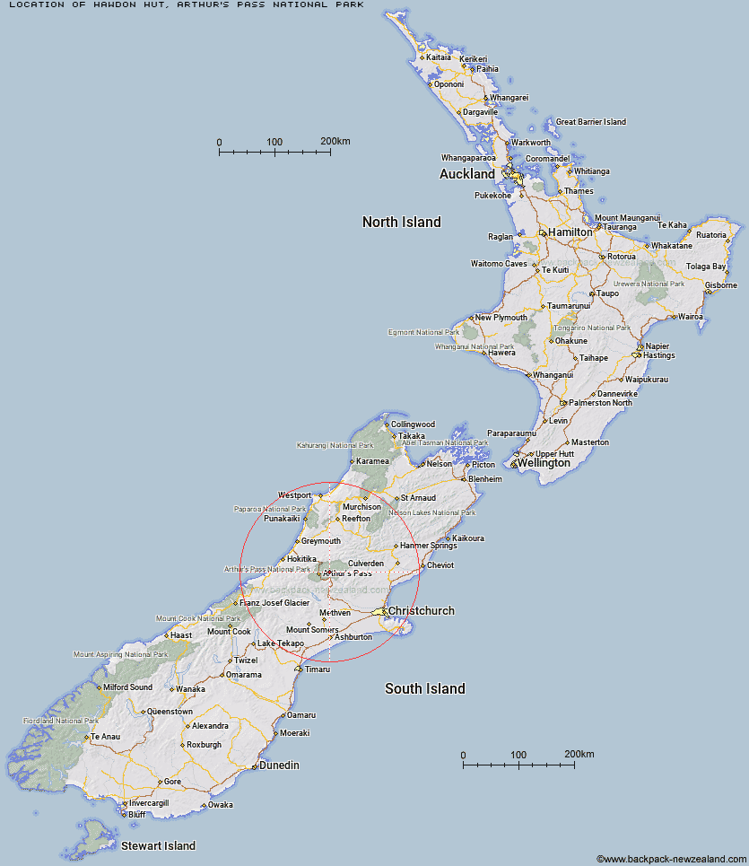
Topo Map showing location of Hawdon Hut
This information is sourced from DoC, LINZ and Openstreetmap. Some of the hut photos are mine and the rest are from DoC. I will be adding an upload feature soon so people can photos of .Hawdon Hut.
Basic info: serviced twenty-bunk hut in the North Canterbury and Arthur's Pass area.
Latitude: -42.9111361952
Longitude: 171.732715652
Location: Arthur's Pass National Park
Area: Canterbury
Type of Hut: Serviced
Tracks: Edwards - Hawdon Route
Map: BV21 Topo Map | Road Map
Does this hut still exist? Have any more information? Contact
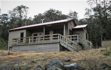
Image: DoC
Scroll down to see a topographical map and road map showing the location of Hawdon Hut
[ A ] [ B ] [ C ] [ D ] [ E ] [ F ] [ G ] [ H ] [ I ] [ J ] [ K ] [ L ] [ M ] [ N ] [ O ] [ P ] [ Q ] [ R ] [ S ] [ T ] [ U ] [ V ] [ W ] [ Y ] [ Z ]
Closest 20 Huts to Hawdon Hut
These are as the crow fliesEast Hawdon Bivouac 3.75km Sudden Valley Bivouac 4.86km Otehake Hut 6.22km Edwards Hut 7.69km Worsley Bivouac 7.8km Mingha Bivouac 8.47km Hawdon Shelter 8.59km Goat Pass Hut 8.85km Poulter Hut 9.31km Upper Deception Hut 9.89km Andrews Shelter 10.44km Riversdale Hut 10.59km Trust/Poulter Hut 10.94km Koropuku Hut 11.03km Poulter Bivouac 11.11km Pfeifer Bivouac 13.19km Greyneys Shelter 14.16km Jacks Hut 14.19km Minchin Bivouac 14.4km Ranger Bivouac 14.7km Turnbull Bivouac 15.16km Klondyke Shelter 15.46km Townsend Hut 15.65km Bealey Hut 15.91km Kiwi Hut 17.17km Crow Hut 17.92km Bealey Spur Hut 18.95km Lagoon Saddle Hut 19.23km Lagoon Saddle A Frame Hut 19.23km Bull Creek Hut 19.3km Carroll Hut 19.91km Waimakariri Falls Hut 19.97km Hunts Creek Hut 20.39km Anti Crow Hut 20.53km Locke Stream Hut 20.64km Cass Saddle Hut 20.93km Lochinvar Hut 22.51km Top Crooked Hut 23.24km West Harper Hut 23.34km Carrington Hut 23.77km