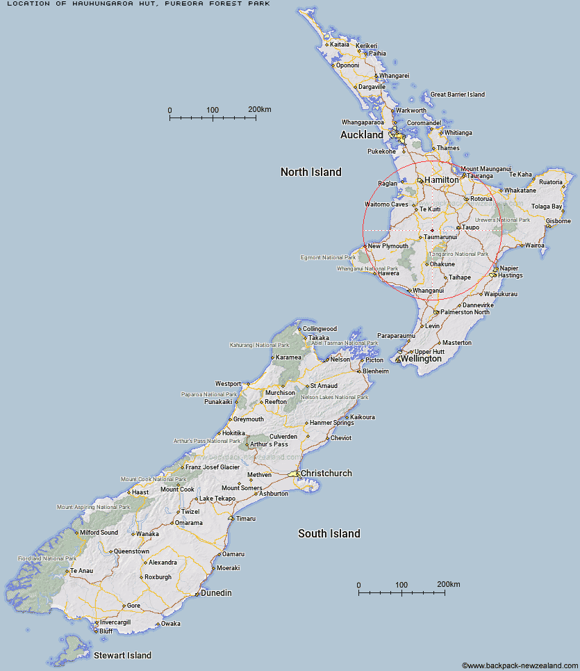
Topo Map showing location of Hauhungaroa Hut
This information is sourced from DoC, LINZ and Openstreetmap. Some of the hut photos are mine and the rest are from DoC. I will be adding an upload feature soon so people can photos of .Hauhungaroa Hut.
Basic info: standard six-bunk hut in the Waitomo/Pureora area.
Latitude: -38.749377112
Longitude: 175.517985085
Location: Pureora Forest Park
Area: Waikato
Type of Hut: Standard
Tracks: Pureora Forest Park tramping tracks
Map: BG34 Topo Map | Road Map
Does this hut still exist? Have any more information? Contact
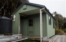
Image: DoC
Scroll down to see a topographical map and road map showing the location of Hauhungaroa Hut
[ A ] [ B ] [ C ] [ D ] [ E ] [ F ] [ G ] [ H ] [ I ] [ J ] [ K ] [ L ] [ M ] [ N ] [ O ] [ P ] [ Q ] [ R ] [ S ] [ T ] [ U ] [ V ] [ W ] [ Y ] [ Z ]
Closest 20 Huts to Hauhungaroa Hut
These are as the crow fliesWaihaha Hut 9.38km Bog Inn Hut 20.84km Ten Man Hut 30.34km Ketetahi Shelter 41.55km Wildlife Hut 41.84km Mangatepopo Hut 44.48km Oturere Hut 47.86km Old Waihohonu Hut 52.86km Waihohonu Hut 53.04km Ohuraiti Hut 53.75km Whakapapaiti Hut 54.3km Waipakihi Hut 56.43km Whangaehu Hut 59.59km Mangaturuturu Hut 60.9km Cascade Hut 61.81km Rangipo Hut 61.92km Blyth Hut 64.76km Lupton Hut 64.87km Hamilton Tomo Group Hut 65.99km Mangaehuehu Hut 66.08km WTFRW Hut 67.53km Rerekapa Hut 72.02km Te Apunga Hut 72.64km Leitchs Hut 73.43km Oamaru Hut 74.09km Poronui Hut 74.97km John Coull Hut 75.01km Tussock Hut 76.01km Golden Hills Hut 76.05km Red Hut 76.86km East Creek Hut 76.88km Bob's Hut 79.26km Tieke Kainga 79.57km Harkness Hut 79.67km Mangatainoka Hut 80.18km Puketotara Hut 81.49km Te Puke (Te Pukeohikarua) Hut 82.1km Ngaawapurua Hut 83.05km Westlawn Hut 83.42km Otutu Island Hut 83.45km