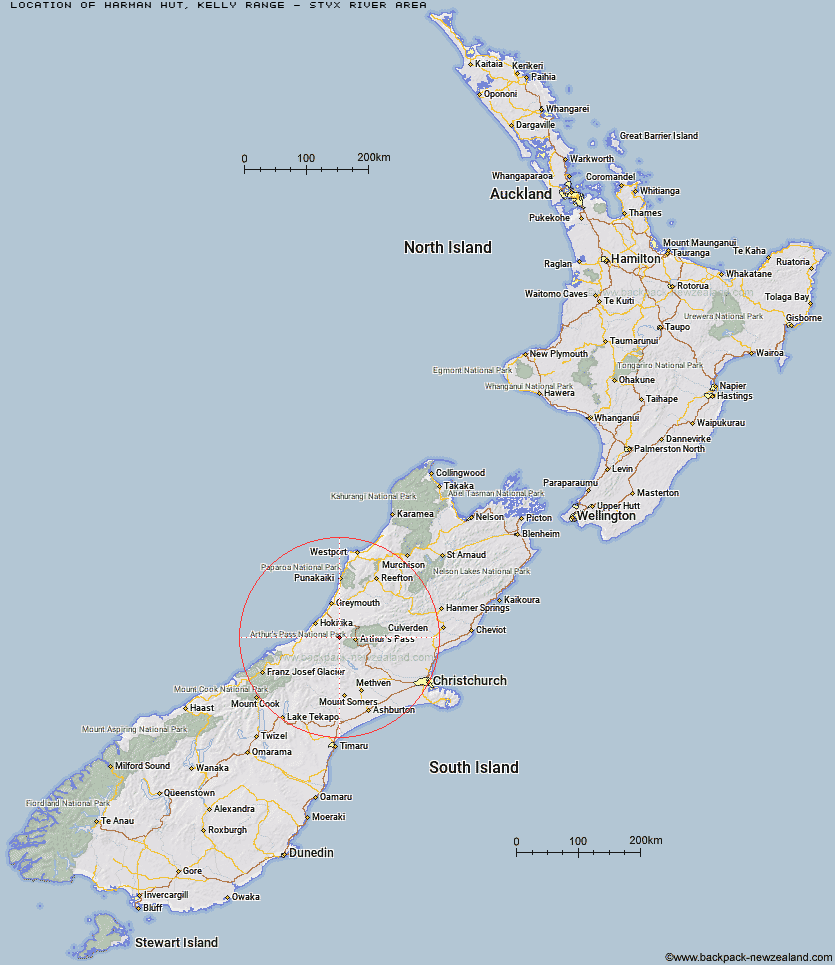
Topo Map showing location of Harman Hut
This information is sourced from DoC, LINZ and Openstreetmap. Some of the hut photos are mine and the rest are from DoC. I will be adding an upload feature soon so people can photos of .Harman Hut.
Basic info: standard six-bunk hut in the Hokitika area.
Latitude: -42.9195759913
Longitude: 171.321630032
Location: Kelly Range - Styx River area
Area: West Coast
Type of Hut: Standard
Tracks: Three Passes Route
Map: BV19 Topo Map | Road Map
Does this hut still exist? Have any more information? Contact
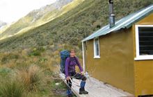
Image: DoC
Scroll down to see a topographical map and road map showing the location of Harman Hut
[ A ] [ B ] [ C ] [ D ] [ E ] [ F ] [ G ] [ H ] [ I ] [ J ] [ K ] [ L ] [ M ] [ N ] [ O ] [ P ] [ Q ] [ R ] [ S ] [ T ] [ U ] [ V ] [ W ] [ Y ] [ Z ]
Closest 20 Huts to Harman Hut
These are as the crow fliesCampbell Bivouac 3.65km Grassy Flat Hut 3.88km Top Crawford Hut 3.9km Browning Range Bivouac 4.12km Park Morpeth Hut 6.04km Newton Range Bivouac 6.04km Mudflats Hut 6.29km Mid Styx Hut 6.79km Lower Arahura Hut 7.26km Crawford Junction Hut 8.43km Julia Hut 8.73km Old Julia Hut 8.79km Lower Olderog Bivouac 9.15km Newton Creek Hut 9.83km Barker Hut 9.89km Boo Boo Hut 10.08km Top Olderog Bivouac 10.94km Carrington Hut 11.25km Mt Brown Hut 11.38km Pinnacle Bivouac 11.84km Mid Taipo Hut 12.57km Urquhart's Hut 12.74km Dunns Creek Hut 12.84km Top Kokatahi Hut 12.9km Waimakariri Falls Hut 13.52km Adventure Bivouac 13.97km Griffin Creek Hut 14.43km Scottys Bivouac 14.52km Weka Burnet Bivouac 14.91km Cedar Flat Hut 15.23km Mungo Hut 15.57km Yeats Ridge Hut 15.8km Crow Hut 16.13km Crystal Bivouac 16.19km Rocky Creek Bivouac 16.43km Unknown Stream Hut 16.73km Hunts Creek Hut 17.09km Top Toaroha Hut 17.18km Toaroha Saddle Bivouac 17.26km Avoca Hut 17.29km