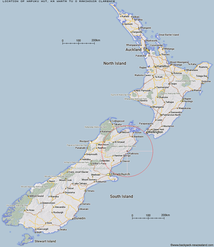
Topo Map showing location of Hapuku Hut
This information is sourced from DoC, LINZ and Openstreetmap. Some of the hut photos are mine and the rest are from DoC. I will be adding an upload feature soon so people can photos of .Hapuku Hut.
Basic info: standard 6-bunk hut in the South Marlborough area.
Latitude: -42.2725415811
Longitude: 173.651512056
Location: Ka Whata Tu o Rakihouia Clarence
Area: Marlborough
Type of Hut: Standard
Map: BT27 Topo Map | Road Map
Does this hut still exist? Have any more information? Contact
Basic info: standard 6-bunk hut in the South Marlborough area.
Latitude: -42.2725415811
Longitude: 173.651512056
Location: Ka Whata Tu o Rakihouia Clarence
Area: Marlborough
Type of Hut: Standard
Map: BT27 Topo Map | Road Map
Does this hut still exist? Have any more information? Contact
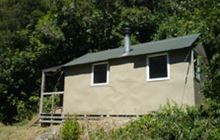
Image: DoC
Scroll down to see a topographical map and road map showing the location of Hapuku Hut
[ A ] [ B ] [ C ] [ D ] [ E ] [ F ] [ G ] [ H ] [ I ] [ J ] [ K ] [ L ] [ M ] [ N ] [ O ] [ P ] [ Q ] [ R ] [ S ] [ T ] [ U ] [ V ] [ W ] [ Y ] [ Z ]
Closest 20 Huts to Hapuku Hut
These are as the crow fliesBarratts Hut 3.53km Barratts Bivouac 3.64km Kowhai Hut 5.46km Mt Fyffe Hut 7.46km Dubious Bivouac 9.58km Fidgit Bivouac 10.8km Limestone Hut 11.67km Goose Flat Hut 15.83km Haycocks Bivouac 17.23km Tent Poles Hut 17.28km Warden Hut 17.54km Black Spur Historic Hut 18.52km Jam Hut 20.37km Kahutara Bivouac 20.87km Ravine Hut 21.37km Seymour Hut 21.56km Hornby Bivvy 24.15km Alfred Hut 25.58km Snowgrass Hut 25.59km Lake McRae Hut 29.38km Stone Jug Hut 30.43km Dee Hut 31.42km Palmer Hut 32.22km Gibson Hut 32.33km Palmer Bivouac 33.25km Cabbage Tree Hut 35.04km Old Middlehurst Hut 35.53km Mead Hut 35.81km Cam Hut 40.7km Cloudy Hut 41.47km Half Moon Hut 42.15km Swale Hut 42.8km Whernside Hut 42.82km Flynns 42.92km Munroe Hut 43.4km Beechs Hut 43.41km Carters Yards Hut 44.13km Burnt Yards Hut 44.89km Zoo Hut 45.02km Junction Hut 45.41km