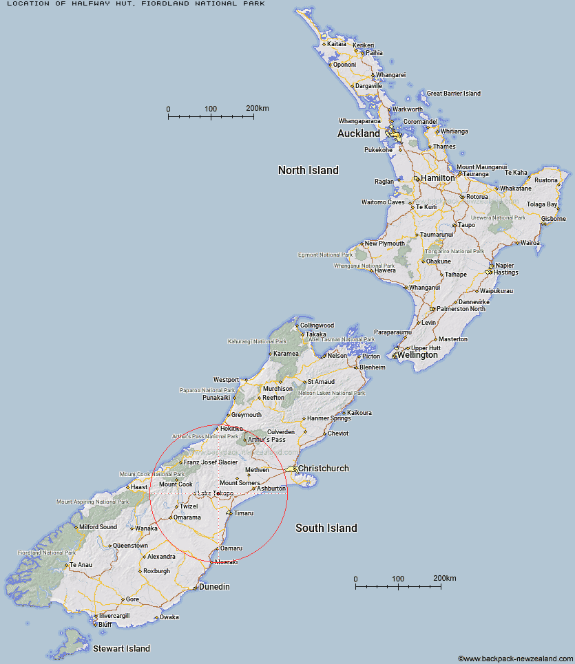
Topo Map showing location of Halfway Hut
This information is sourced from DoC, LINZ and Openstreetmap. Some of the hut photos are mine and the rest are from DoC. I will be adding an upload feature soon so people can photos of .Halfway Hut.
Basic info: standard 12-bunk hut in western Fiordland.
Latitude: -44.0069645068
Longitude: 171.000687684
Location: Fiordland National Park
Area: Fiordland
Type of Hut: Standard
Tracks: Dusky Track
Map: CE06 Topo Map | Road Map
Does this hut still exist? Have any more information? Contact
Basic info: standard 12-bunk hut in western Fiordland.
Latitude: -44.0069645068
Longitude: 171.000687684
Location: Fiordland National Park
Area: Fiordland
Type of Hut: Standard
Tracks: Dusky Track
Map: CE06 Topo Map | Road Map
Does this hut still exist? Have any more information? Contact
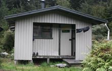
Image: DoC
Scroll down to see a topographical map and road map showing the location of Halfway Hut
[ A ] [ B ] [ C ] [ D ] [ E ] [ F ] [ G ] [ H ] [ I ] [ J ] [ K ] [ L ] [ M ] [ N ] [ O ] [ P ] [ Q ] [ R ] [ S ] [ T ] [ U ] [ V ] [ W ] [ Y ] [ Z ]
Closest 20 Huts to Halfway Hut
These are as the crow fliesPleasant Gully Hut 3.93km Devil's Creek Hut 4.9km Sutherland's Hut 7.87km Bottom Mount Peel Hut 20.01km Ribbonwood Hut 20.5km Spurs Hut 22.54km Top Mount Peel Huts 23.79km South Opuha Hut 25.35km Taffy Hut 28.19km Felt Hut 34.19km Camp Stream Hut 36.81km Royal Hut 37.86km Rex Simpson Hut 39.72km Stone Hut 40.12km Crooked Spur Hut 45.84km Stony Stream Hut 48.82km Dog Kennel Bivouac 49.46km Middle Gorge Hut 50.86km Ribbonwood Hut 51.69km Woolshed Creek Hut 52.12km Boundary Creek Hut 53.39km Telegraph Hut 53.7km Pinnacles Hut 53.74km Black Mountain Hut 53.88km Waterfall Hut 54.44km Ryders Hut 54.45km Manuka Hut 56.21km Tin Hut 56.78km Macaulay Hut 57.15km Potts Hut 57.42km Angus Hut 57.59km Three Creeks Hut 57.93km Growler Hut 59.03km Cookshop Hut 59.7km Maryburn Hut 59.9km Double Hut 60.57km Birdcage Hut 60.93km Memorial Hut 61.51km Rankin Hut 61.64km Alford Hut 62.13km