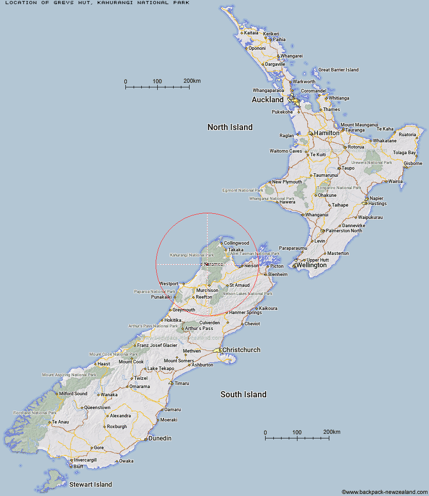
Topo Map showing location of Greys Hut
This information is sourced from DoC, LINZ and Openstreetmap. Some of the hut photos are mine and the rest are from DoC. I will be adding an upload feature soon so people can photos of .Greys Hut.
Basic info: basic six-bunk hut in the Buller area.
Latitude: -41.2391177971
Longitude: 172.275720971
Location: Kahurangi National Park
Area: West Coast
Type of Hut: Basic/bivvies
Map: BQ22 Topo Map | Road Map
Does this hut still exist? Have any more information? Contact
Basic info: basic six-bunk hut in the Buller area.
Latitude: -41.2391177971
Longitude: 172.275720971
Location: Kahurangi National Park
Area: West Coast
Type of Hut: Basic/bivvies
Map: BQ22 Topo Map | Road Map
Does this hut still exist? Have any more information? Contact
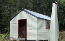
Image: DoC
Scroll down to see a topographical map and road map showing the location of Greys Hut
[ A ] [ B ] [ C ] [ D ] [ E ] [ F ] [ G ] [ H ] [ I ] [ J ] [ K ] [ L ] [ M ] [ N ] [ O ] [ P ] [ Q ] [ R ] [ S ] [ T ] [ U ] [ V ] [ W ] [ Y ] [ Z ]
Closest 20 Huts to Greys Hut
These are as the crow fliesAdams Flat Hut 7.02km Sunshine Flat Shelter 9.71km Kākāpō Hut 10.64km Belltown Manunui Hut 12.73km Roaring Lion Hut 13.98km Wangapeka Bivouac 15.64km Venus Hut 16.19km Crow Hut 17.22km Stag Flat Shelter 17.57km Taipo Hut 17.94km Thor Hut 18.54km Karamea Bend Hut 19.69km Trevor Carter Hut 20.1km Kohaihai Shelter 20.44km Helicopter Flat Hut 20.92km Stone Hut 24.37km Johnson Hut 25.38km Katipo Creek Shelter 25.87km Kiwi Saddle Hut 26.13km Flanagans Hut 26.62km Splugeons Rock Shelter 28.09km Tent Camp 29.09km Cobb Hut 29.17km John Reid Hut 29.19km Chaffey Hut 29.45km Fenella Hut 29.67km Balloon Hut 30.03km Trilobite Hut 30.42km Kings Creek Hut 30.46km Cecil Kings Hut 30.51km Hurricane Hut 31.07km Myttons Hut 31.15km Heaphy Hut 31.29km Dry Rock Shelter 32.88km Sylvester Hut 34.21km Ellis Hut 34.28km Growler Rock Shelter 34.34km Lewis Hut 34.94km Mokihinui Forks Hut 35.31km Specimen Point Hut 35.51km