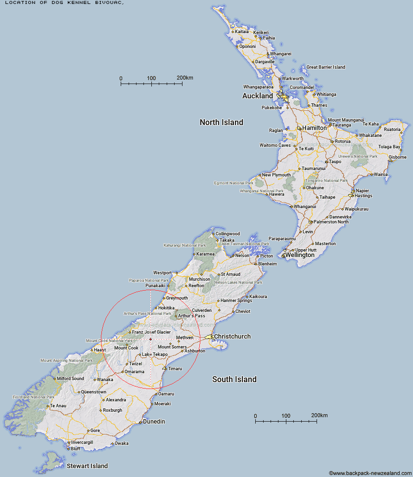
Topo Map showing location of Dog Kennel Bivouac
This information is sourced from DoC, LINZ and Openstreetmap. Some of the hut photos are mine and the rest are from DoC. I will be adding an upload feature soon so people can photos of .Dog Kennel Bivouac.
Latitude: -43.5839114004
Longitude: 170.8101877
Location:
Type of Hut:
Map: Topo Map | Road Map
Does this hut still exist? Have any more information? Contact
Latitude: -43.5839114004
Longitude: 170.8101877
Location:
Type of Hut:
Map: Topo Map | Road Map
Does this hut still exist? Have any more information? Contact
Scroll down to see a topographical map and road map showing the location of Dog Kennel Bivouac
[ A ] [ B ] [ C ] [ D ] [ E ] [ F ] [ G ] [ H ] [ I ] [ J ] [ K ] [ L ] [ M ] [ N ] [ O ] [ P ] [ Q ] [ R ] [ S ] [ T ] [ U ] [ V ] [ W ] [ Y ] [ Z ]
Closest 20 Huts to Dog Kennel Bivouac
These are as the crow fliesDog Kennel Bivouac 0km Crooked Spur Hut 4.74km Black Mountain Hut 4.95km Growler Hut 9.95km Stone Hut 11.82km Carneys Bivvy's 15.39km Erewhon Station Hut 15.5km Felt Hut 16.09km Potts Hut 16.56km Curtis Memorial Hut 16.62km Macaulay Hut 16.66km Murphys Bivvy 16.78km Royal Hut 16.93km Mistake Flats Hut 17.76km Stony Stream Hut 18.24km Forbes Bivouac 18.6km Lawrence Hut 19.07km Watchdog Hut 19.62km Saint Winifreds Hut 21.2km Hermitage Hut 21.76km Boundary Creek Hut 21.9km McCoy Hut 23.03km Taffy Hut 24.07km Rex Simpson Hut 25.04km Red Stag Hut 25.27km Top Hut 25.3km Camp Stream Hut 26.69km Godley Hut 26.77km Rankin Hut 27.01km Eade Memorial Hut 27.41km Spurs Hut 27.45km Lawrence Bivouac 27.54km Ribbonwood Hut 27.86km Angus Hut 28.13km Highland Home 28.3km Cameron Hut 29.37km Scone Hut 30.23km Ribbonwood Hut 31.63km Lyell Hut 32.67km Murchison Hut 34.29km